Sumatra Continuing Seismic
Noise – Danger Continues
From Harry Mason
orbitx@bigpond.com
1-1-5
Dear Jeff,
Re: SUMATRA BOXING DAY SEISMIC EVENT
I note that all seismic info web sites are showing large (6.0-5.0 richter scale) quakes continuing every couple of hours along the Andaman-Sumatra fault line. These have been occurring ever since Boxing Day (26-12-04) right up until today (1-01-05). The continuing quakes demonstrate VERY “noisy” high energy background seismograph records when viewed on seismograms collected from seismic stations located within a few thousand kilometers of the original 9.0 richter event. This may indicate continued high frequency micro-quakes of the type associated with volcanic intrusion in the upper crust – on a massive scale – along the Andaman-Sumatra island arc zone.
The IRIS and USGS web sites show the spread of recent quakes running along some 1000km of fault line from the Andamans to NW Sumatra. But the European Seismic Centre at http://www.emsc-csem.org/ has been re-calculating the many quake epi-centres and their work suggests these quakes are (mostly) clustering around the same point – off NW Sumatra.
Given the violent off-scale nature of seismograms over the last few days it is difficult to generate either precise richter level info OR precise Lat-Long co-ordinates for specific events. In fact the noise level on many seismograms suggest this has been and is a nearly continuous energy event with regular high energy peaks every few hours. This may indicate that igneous intrusive action is occurring here on a massive scale deep within the crust associated with continual faulting movement along the proto island arc???
A long dormant Andaman volcano has begun to errupt over the last few days and an Indian Government geologist has said that this erruption is nothing to be concerned about. Many volcanoes along the Andaman-Sumatran arc are of a highly explosive type – but I am unfamiliar with the specific newly errupting volcano type.
If you read the information below (taken from Dr. George Pararas-Carayannis site re the 1883 explosion of Krakatoa you might wish to contest the statement that “there is nothing to be concerned about” !!!
You should note that some 1000 years previously an exploding proto Krakatoa was literally the cause of the “DARK AGES” !!! But more recently, in 1883, it began all over again as follows :
“After a long period of inactivity (about 200 years), Krakatoa became active again in early 1883. The first indication that something was happening on Krakatoa was when a large earthquake struck the area. Seismic activity became stronger until May 20,1883, when the volcano abruptly came to life. The initial explosive eruptions of Krakatoa could be heard 160 km away. Steam and ash could be seen rising 11km above the summit of the volcano. By August 11, 1883. three vents were actively erupting. Eleven other vents were ejecting smaller quantities of steam, ash and dust.
Around 1 pm on the 26th of August 1883, the explosions became more frequent occurring on the average every 10 minutes. Sailors on a ship, 120 km away from the island reported a black cloud of smoke rising above the volcano. At the time the rim of Krakatoa’s crater was approximately 1,000 meters in diameter and had and average depth of 50 meters. The volcano’ s central vent was blocked by a plug of solid lava and underneath it pressure was rapidly building up.
The Great Eruption:
The renewed activity in May 1883 culminated in four gigantic explosions on August 26 and 27 of the same year. On the afternoon of August 26, 1883, (27 August local date) at 17: 07 Greenwich time (GMT), the first of these four violent explosions begun. A black cloud of ash was initially observed. It rose 17 miles (27 kilometers) above Krakatoa. In the morning of the next day, on August 27, 1883, at 05:30, 06:44 and 10:02 GMT, three more violent eruptions occurred. It was the paroxysmal eruption which occurred at 10:02 which blew away the northern two-thirds of the island. This was the most severe violent volcanic explosion on Earth in modern times. The explosion was followed by the collapse of the unsupported volcanic chambers of Krakatoa forming the huge underwater caldera. It was this explosion and collapse of Krakatoa that generated catastrophic tsunami waves as high as 37 meters. (120 ft.) that caused havoc and destruction in the Sunda Strait.”
Well as you can see from the initial early 1883 Krakatoa region “large earthquake” a series of events unfolded that culminated in a massive explosion at Krakatoa and a huge tsunamis on August 27th 1883. Thus it took about 7 months for the Krakatoa incident to fully develop. Krakatoa also had a huge loss of life – if repeated today the loss of life could be MUCH higher.
It is early days yet BUT I do not believe that the danger from this Boxing Day Sumatra event has passed. The locality off NW Sumatra has now demonstrated unprecidented seismic instability over a duration of several days and the region has a VERY VIOLENT and well documented quake-tsunamis-volcanic erruption history. Whatever precipitated this disasterous event it is highly unlikely that it is over and therefore danger remains.
Keep your wits about you since yet more massive quakes and/or explosive volcanic erruptions and tsunamis may well occur over the next few months (or year(s)) – NB these may NOT be limited to the Indian Ocean region.
The world chart of real time earthquakes seems to indicate that fresh quakes are initiating in other stressed parts of the planets crust – particularly along the New Guinea-Japan-Alaska-California fault systems – probably in response to the dis-equilibrium in the Earth’s tectonic stress field created by the 8.3r Macquarie Island quake and then the 9.1r Sumatra and subsequent quakes. The next few weeks will be critical in developing our understanding of this event.It will pay to keep abreast of this unfolding seismic event for several months if not years.
If a new major quake -tsunamis happened today or tomorrow is there any system in place to warn the relevant populations and get them out of harms way ???
Even here in Perth – Western Australia no such warning system exists yet. Sure radio etc. could give warnings but there are no evacuation plans, sirens, nor established disaster alert procedures – certainly none that 99% of the population are aware of. We need to educate public NOW and set up an immediate warning system. If nothing is in place here in a relatively developed society whatabout the rest of the largely third world Indian ocean. A seismic event warning system is an absolute MUST for the Indian Ocean. It should in fact be mandatory for the entire planet. There is ample geological evidence for previous catastrophic seismic related events just about where ever we look AND these type of incidents were recorded by the ancient Egyptians (33 known catastrophic events).
It will NOT cost much to develop, install, and operate such a system (probably MUCH less than We spend every day in Iraq). It should be rushed into operation NOW = THIS WEEK, as an adhoc system, then tuned up ASAP over future weeks. We are at continued MAJOR risk over the next few months from possible developments resulting from this Boxing Day Sumatra seismic event.
Such events WILL happen again – all be it most likely over long (say 100 year) time intervals but the cost is so high we MUST install insurance procedures NOW.
This is something our governments and the UN should initiate IMMEDIATELY.
Best Regards,
Harry Mason Geologist-Geophysicist
Perth Western Australia
http://www.rense.com/general61/seis.htm
5 years ago
Parts of Alaska Turned Into Soggy Mess
Wed Jan 5, 5:24 AM ET
By RACHEL D’ORO, Associated Press Writer
ANCHORAGE, Alaska – You might expect January in Alaska to be frightfully frigid. But this year, in some parts, you barely even need a coat outside.
South-central Alaska is so warm, an annual winter dog weight-pulling contest in Anchorage has been canceled because there’s not enough snow. Kenai Peninsula roads have taken a beating with constant freezing and thawing.
Winters in the state can vary wildly, as any old-timer knows. But weather records dating back to 1917 show that most months of January have some kind of warming episode, said Bob Hopkins, chief meteorologist with the Anchorage office of the National Weather Service (news – web sites).
“It would be more unusual if we didn’t have a couple of 40-degree days,” Hopkins said. “Generally, those days are windy, mucky, slippery and just plain lousy.”
The towns of Homer and Palmer had high temperatures of 46 degrees Tuesday, and it reached 43 degrees in Anchorage. But it was expected to cool down Wednesday, with a high of 37.
Some years the mild spells are more pronounced than others, especially winters like this one that are toyed with by El Nino, a phenomenon caused by disruptions in the Pacific Ocean’s temperature.
So folks in Alaska, particularly in the southern end, might be trudging through slushy puddles while elsewhere people are bundled up in mittens and parkas.
Pat Anderson wishes Anchorage snow would stick. Anderson, an executive with Spenard Builders Supply, had to cancel an annual dog weight-pulling contest the company has sponsored for 17 years. The event, which had been scheduled for Saturday, features dogs competing by pulling heavy loads on sleds.
“It’s become such a tradition,” Anderson said. “But safety is an important thing for the dogs and we don’t have enough of a snow and ice pack. That’s what makes the loads go into a slide — and we’re just down to gravel. Hopefully, it will be held again next year.”
The contest also was scrubbed in 2002, a year of little snow. An unusually warm winter that year also forced organizers of the Iditarod Trail Sled Dog Race to change the traditional route and move the start north to Fairbanks.
It’s too early to worry about weather woes in this year’s race, Iditarod executive director Stan Hooley said from headquarters in soggy Wasilla. Besides, farther north, mushers were enjoying the bounty of snow.
“Today it certainly doesn’t look good here but my calendar tells me there are 59 days before this thing takes place,” he said. “We all know things in Alaska can change dramatically in 24 hours.”
http://news.yahoo.com/news?tmpl=story&cid=519&u=/ap/20050105/ap_on_re_us/warm_alaska_2&printer=1
5 years ago
Three storms threaten to strike U.S. at once
WASHINGTON — Moisture-laden storms from the north, west and south are likely to converge on much of America over the next several days in what could be a once-in-a-generation onslaught, meteorologists forecast yesterday.
If the gloomy computer models at the U.S. Climate Prediction Center are right, we’ll see this terrible trio:
• The “Pineapple Express,” a series of warm, wet storms heading east from Hawaii, drenching Southern California and the far Southwest, already beset with heavy rain and snow. Flooding, avalanches and mudslides are possible.
• An “Arctic Express,” a mass of cold air chugging south from Alaska and Canada, bringing frigid air and potentially heavy snow and ice to the usually mild-wintered Pacific Northwest.
• An unnamed warm, moist storm system from the Gulf of Mexico drenching the already-saturated Ohio, Tennessee and Mississippi valleys. Expect heavy river flooding and springlike tornadoes.
Meteorologists caution that their predictions are only as good as their computer models. And forecasts are less accurate the further into the future they attempt to predict. “The models tend to overdo the formation of these really exciting weather formations for us,” said Mike Wallace, a University of Washington atmospheric scientist.
Yet the more Wallace studied the models, the more he became convinced that something wicked was coming this way.
“It all fits together nicely,” he said. “There’s going to be weather in the headlines this weekend, that’s for sure.”
The National Weather Service yesterday issued a statement warning that several inches of snow could fall by the end of the weekend in the central Puget Sound lowlands, including Seattle. The snow could begin as soon as tomorrow night, particularly in areas north of Seattle, with a growing chance of snow farther south Friday, the weather service said. Highs through this weekend are expected to be in the low- to mid-30s, with lows in the mid- to high-20s.
“Don’t sound the alarm,” weather service meteorologist Johnny Burg said. “But tell everybody to just pay attention to future forecasts.”
The three storms are likely to meet in the nation’s midsection and cause even more problems, sparing only areas east of the Appalachian Mountains. Property damage and a few deaths are likely, forecasters said.
“You’re talking a two- or three-times-a-century type of thing,” said prediction-center senior meteorologist James Wagner, who has been forecasting storms since 1965. “It’s a pattern that has a little bit of everything.”
The exact time and place of the predicted 1-2-3 punch changes slightly with every new forecast. But the National Weather Service, in its weekly “hazards assessment,” alerted meteorologists and disaster specialists yesterday that flooding and frigid weather could start as early as Friday and stretch into early next week, if not longer.
“It’s a situation that looks pretty potent,” said Ed O’Lenic, the Climate Prediction Center’s operations chief. “A large part of North America looks like it’s going to be affected.”
Kelly Redmond, deputy director of the Western Regional Climate Center at the Desert Research Institute in Reno, Nev., where an unusual 18 inches of snow is on the ground, said the expected heavy Western rains could cause avalanches. Southern California and western Arizona have had three to four times the normal precipitation for the area since Oct. 1.
“Somebody is in for something pretty darn interesting,” Redmond said.
Somebody already knows.
A wintry blast yesterday closed schools and glazed roads with ice and snow in the Rockies and on the central Plains, a 40-mile stretch of Interstate 5 was closed north of Los Angeles after up to 3 feet of snow fell in the region, and new flooding hit northeast of Phoenix, killing one man and leaving another missing.
Various levels of winter-weather advisories and storm warnings were in effect into this morning from Arizona to Connecticut, the weather service said.
Up to 2 feet of snow was possible in Colorado, where one traffic fatality was blamed on the weather and an avalanche blocked U.S. 550 about 40 miles north of Durango, the weather service said.
The last time a similar situation seemed to be brewing — especially in the West — was in January 1950, O’Lenic said. Seattle received 21 inches of snow, killing 13 people in an extended freeze, and Sunnyvale, Calif., was the scene of an unusual tornado.
The same scenario played out in 1937, when there was record flooding in the Ohio River Valley, said Wagner, of the prediction center.
He was worried about the Ohio and Tennessee River valleys as the places where the three nasty storm systems could meet, probably with snow, thunderstorms, severe ice storms and flooding. Some of those areas already are flooded.
The converging storms are being steered by high-pressure ridges off Alaska and Florida and are part of a temporary change in world climate conditions, O’Lenic said.
Over equatorial Indonesia, east of where a tsunami hit Dec. 26, meteorologists have identified a weather-making phenomenon called the Madden-Julian Oscillation. It’s producing extra-stormy weather to its east. Similar oscillations in the north Atlantic and north Pacific are changing global weather patterns. Add this year’s mild El Niño — a warming of the equatorial Pacific — which is unusually far west, Redmond said.
http://seattletimes.nwsource.com/html/nationworld/2002141092_storm05.html
5 years ago
Russians confirm planetary angular momentum theory to warn of another major tsunami even more devastating
Kiran Chaube, Special Correspondent
January 01, 2005

The earth has entered a seismically active period when weakness in earth’s crusts start breaking apart, volcanoes erupt, plate collisions cause major earthquakes, mud volcanoes erupt and geysers come out in different parts of the world with much higher frequency. This results in volcanic eruption, mudslides, Tsunamis, mega earthquakes and more.
According to the Russian scientists, the number of earthquakes in the earth has increased exponentially over the past few years, a phenomenon not seen in modern human history.
According thousands of years old Mayan civilization, this kind of period come after thousands of years. The ancient civilization warned that around 2012 the world would face major calamities from natural disasters and other factors. They used planetary positions and interferences as well as sun signs.
According to some Russian scientists, another major earthquake in the same vicinity and a series of the same near the equator is evident in near future. The resultant Tsunamis will be three to five time as severe as this one. The future Tsunamis will not effect South and South east Asia, they will devastate even many more countries.
“According to our theory, there exist latitudinal lineaments (cracks of the earth’s core), which pose potential danger in terms of seismic activity. If we are to follow equatorial crack westward of South East Asia, we could expect rather serious seismic cataclysms in Equatorial Guinea, Cameroon, Nigeria and Gabon,” informed the spokes person of the Russian scientists.
According to Pravda, earthquakes are also likely to hit equatorial countries of South America. Southern part of Ecuador and the islands in close proximity to it will be most susceptible to the quake. Should the seaquakes occur, the waves can easily cover the entire southern part of Colombia, Ecuador and northern part of Peru, noted Dr. Evgeny Dolgivov, director of geological-mineral sciences.
Dolginov has come up with a new theory of latitudinal lineaments, which according to the professor, had emerged during earth’s early stages of development, reports “Interfax”. Such cracks tend to become seismically active from time to time. In a place where such cracks intersect seismically active zones (i.e. meridian), these zones become most dangerous in regards to earthquakes. This was exactly what happened in South-East Asia, considers the scientist.
Tsunamis, earthquakes, mudslides and volcanic eruptions are evident in many parts of the world, say some Geological and Earthquake experts.
The angular momentum theory also says earth has become more wobbly and there is fair possibility that we will see a polar inversion like North Pole will become South Pole and vice versa. This kind polar inversion has never been experienced by modern human race. No one knows the implication and resultant havoc that can happen in the earth’s crust.
Some experts are also saying that based on myths and ancient stories, Atlantis faced even larger – many times larger similar devastation. But the mega devastation that demolished a complete advanced civilization over night did not happen suddenly. Smaller volcanic eruptions, earthquakes and Tsunamis first started happening one year before the big one came. Normally the small ones occur around the epicenter of the future big one. People normally misunderstand the small ones as the big one.
http://www.indiadaily.com/editorial/01-01-05.asp
5 years ago
Many Governments knew but did nothing to evacuate coastal areas – global conspiracy, UFO threats or concerted failure?

Sudhir Chadda, Special Correspondent
January 03, 2005
Recent alien contacts have been reported with the South Asian Governments especially India. UFO sightings have been rampant over the region affected. Some in Nicobar Island say that it was an experiment conducted by the alien extra-terrestrial entities to correct the wobbly rotation of the earth. And some of the Indian scientists are actually seeing that wobbly rotation of the earth has been corrected since the massive underwater earthquake and Tsunami.
In Indian capital of New Delhi, faxes were being sent to wrong fax numbers so that nothing much is done even though the Government clearly knew about the coming Tsunami. People have started asking the question – was this utter failure or global conspiracy to accommodate some entity or interest or was this for the good of the earth?
If this was an utter failure, how do you justify that all six Governments failed separately in their own domain one by one.
According to some extraterrestrial UFO observers, the UFO sightings before the earthquake and Tsunami were very unusual in that part of the world. They claim the world’s Governments were told not to act for some reason.
The most amazing thing is that United States Geological Survey and Ocean Monitoring agencies came to know about the Tsunami and earthquake but decided not to do anything. Well it seems the whole world decided to fail to do anything together at the same time. Are we missing something?
Can it be that all the Government Agencies knew what was happening but were told not to do anything? Who told them? Or is this just a tragic coincidence?
In Thailand some in the Government said, they decided not to act because that will just scare people. Really? Are we not supposed to get scared of scary things?
http://www.indiadaily.com/editorial/01-03d_1-05.asp
5 years ago
ohhhh noooooo! da cosmiks is out to git us!
5 years ago
oh noooos! da cosmiks about to git us!1!1
5 years ago

Planetary alignment can devastate the world in next few months – Earth shaking Russian Volcano in Kamchatka erupts with massive earthquake
Sudhir Chadda, Special Correspondent
December 29, 2004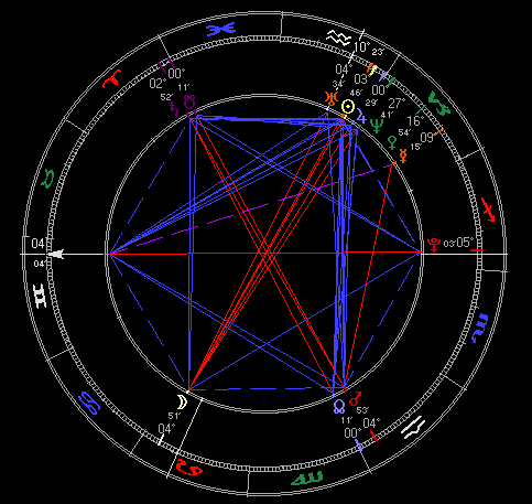
Russian hot spot volcano in Lamchatka Peinsula just exploded with earth shattering ground vibrations. This was the spot on 9.0 Richter earthquake in 1952.
There are no less than 50 other earthquakes that has been registered in the last few months. According tectonic researchers this is just dangerous and unbelievable.
The planetary alignment can cause many earthquakes all around the world of magnitude the modern mankind has never seen before.
There are also reports that Yellow Stone National Park may also explode with lava and earth shattering vibrations.
In west cost of America the Mount Helen is again becoming active and may create havoc soon.

According to some sources, whales have come on the shore in various countries including Australia and natives are saying that those are signs of tremendous under water upheaval.
According to some Indian scientists, Venus, moon and Jupiter is pulling earth away from the Sun in the same one line. The linear momentum can devastate the world in the next few months.
SO

1998 June 2 Solar Storm Picture:
Animal zoo supervisors are reporting from various part of the world that animals are behaving strangely all around the world for the last few months.
In Sri Lanka where more than 14,000 people have died and the animal zoo had a direct hit from the Tsunami, not a single animal has died or is injured. They all ran to higher ground before the Tsunami came. Tsunamis have electromagnetic waves associated that the animals can sense. That may have saved them.
In the mean time death from Tsunami keeps going up. It stands at 65,000 and is approaching 100,000.
Thousands of bodies lay rotting and unidentified on lawns and streets of battered Sumatra island Wednesday and authorities called out bulldozers to dig mass graves, as the number killed in a mammoth earthquake and tsunami soared above 58,000 with tens of thousands still missing. The U.N. health agency warned that disease could double the toll yet again. Across a dozen countries, millions of people whose homes were swept away or wrecked by raging walls of water Sunday struggled to find shelter. “My mother, no word! My sisters, brothers, aunt, uncle, grandmother, no word!” yelled a woman at a makeshift morgue in Lhokseumawe, Indonesia. “Where are they? Where are they? I don’‘t know where to start looking.” Along India’s southeastern coast, hospital teams stood by to help the injured, but three days after the disaster still spent most of their time tabulating the dead as ambulances hauled in more bodies. A French cultural center in Thailand’s capital provided clothes and food for tourist families left with nothing when the sea battered southern beach resorts. One of the most dramatic illustrations of nature’s force came to light Tuesday when reporters reached the scene of a Sri Lankan train carrying beachgoers that was swept into a marsh by a wall of water Sunday, killing at least 802. Eight rust-colored cars lay in deep pools of water in a ravaged palm grove, torn off wheels and baggage scattered among the twisted rails. “Is this the fate that we had planned for? My darling, you were the only hope for me,” a young man cried for one of the train victims — his university sweetheart — as Buddhist monks prayed nearby. Indonesia’s Health Ministry said in a statement early Wednesday that thousands more bodies had been recovered, raising to more than 30,000 the number of confirmed deaths in parts of Sumatra island, the territory closest to the epicenter of the quake that sent tsunami waves rolling across the Indian Ocean. The count did not include a report of thousands more dead in the region around one coastal city. Sri Lanka listed 21,700 people dead, India 4,400 and Thailand 1,500, with the toll expected to rise. A total of more than 300 were killed in Malaysia, Myanmar, Bangladesh, the Maldives, Somalia, Tanzania, Seychelles and Kenya. Officials had not yet counted the dead in two zones that suffered the brunt of both the earthquake and the tsunami that followed: the west coast of Sumatra and India’s remote Andaman and Nicobar archipelagos just north of Sumatra. Purnomo Sidik, national disaster director at Indonesia’s Social Affairs Ministry, said 10,000 people had been reported killed in and around Meulaboh, a poor Sumatran town where most people are fishermen or workers on palm oil plantations. In India, police said 8,000 people were missing and feared dead on the two island chains. Television footage from overflights of Meulaboh and other parts of Sumatra’s west coast showed thousands of homes underwater. Refugees fleeing the coast described surviving on little more than coconuts before reaching Banda Aceh, the capital of Aceh province on Sumatra’s northern tip, which itself was largely flattened by the quake. “The sea was full of bodies,” said one refugee, Sukardi Kasdi, who sailed a small boat to Banda Aceh to seek help for his family in Surang. He said his family had nothing to eat but coconuts. “I don’‘t know how long everyone else will survive,” he said. With aid not arriving quickly enough, desperate people in Meulaboh and other towns in Aceh were stealing whatever food they could find, officials said. “People are looting, but not because they are evil, but they are hungry,” said Red Cross official Irman Rachmat in Banda Aceh. Bulldozers stood ready Wednesday in Banda Aceh to bury the thousands of dead bodies that littered the streets and lined the front lawns of government offices. With the threat of disease on the rise and few ways to identify the dead, officials said they had no choice to but start burying them in mass graves, said Col. Achmad Yani Basuki. “We will start digging the mass graves today,” he said. Sjafrie Sjamsoeddin, a military spokesman, said that naval ships were headed for the west coast with tons of food, water and medicine. He also said the convoy would include a portable hospital. “We have very sketchy information about how many died there and the extent of the devastation. We’‘re having extraordinary problems communicating there,” Sjamsoeddin said. The flooding uprooted land mines in Sri Lanka — torn for years by a civil war — threatening to kill or maim aid workers and survivors attempting to return to what’s left of their homes. Aid groups struggled to mount what they described as the largest relief operation the world has ever seen, and to head off the threat of cholera and malaria epidemics that could break out where water supplies are polluted with bodies and debris. Dr. David Nabarro, head of crisis operations for the World Health Organization, warned that disease could take as many lives as Sunday’s devastation. “The initial terror associated with the tsunamis and the earthquake itself may be dwarfed by the longer term suffering of the affected communities,” he told reporters at the U.N. agency’s offices in Geneva. A government official in India said Sunday’s devastation had overwhelmed authorities, who were only now getting relief operations under control and starting to address health concerns. “It was all sudden and unexpected. There were just too many bodies to recover,” Veera Shanmuga Moni said. “Now that we are close to finishing that job, we will now take care of sanitation and supply of clean water.” The United States, Japan, Australia and other nations pledged millions of dollars to help the relief effort, and some sent military transport planes and helicopters to carry medical teams and emergency supplies. In southern Thailand’s Phang Nga province, where resorts had been packed with thousands of tourists from Europe and elsewhere when the tsunami hit, soldiers and volunteers were still finding bodies lying bloated and rotting in the tropical sun. Survivors lined up at airports to leave the country, many without relatives or lovers they had come with. “I saw many kids perish. I saw parents trying to hold them but it was impossible. It was hell,” said Karl Kalteka of Munich, Germany, who lost his girlfriend in the torrent. Amid the devastation, however, there were miraculous stories of survival. In Malaysia, a 20-day-old baby was found alive on a floating mattress and was reunited with her family. In Thailand, 2-year-old Hannes Bergstroem, who was found dazed and alone after the waves hit, was claimed by an uncle after his photograph was posted on the Internet. The Swedish newspaper Aftonbladet reported that the boy’s mother and grandmother were missing, but later media reports said he was reunited with his grandmother. His father and grandfather were believed to be in another hospital in Thailand, but their exact location and conditions were not immediately known. A U.N. agency has said that one-third of the disaster’s victims were children.
http://www.eanet.com/kodama/astro/2002/0504/c/thumb/18-1.jpg
http://216.132.172.70/indiadaily/editorial/12-29-04.asp
5 years ago
Most Powerful Eruption in the Universe Discovered
NASA/Harvard — Astronomers have found the most powerful eruption seen in the Universe using NASA’s Chandra X-ray Observatory. A supermassive black hole generated this eruption by growing at a remarkable rate. This discovery shows the enormous appetite of large black holes, and the profound impact they have on their surroundings.
The huge eruption is seen in a Chandra image of the hot, X-ray emitting gas of a galaxy cluster called MS 0735.6+7421. Two vast cavities extend away from the supermassive black hole in the cluster’s central galaxy. The eruption – which has lasted for 100 million years and is still going – has generated the energy equivalent to hundreds of millions of gamma-ray bursts.
This event was caused by gravitational energy release as enormous amounts of matter fell toward a black hole. Most of the matter was swallowed, but some of it was violently ejected before being captured by the black hole.
“I was stunned to find that a mass of about 300 million Suns was swallowed,” said Brian McNamara of Ohio University in Athens, lead author of the study that appears in the January 6, 2005 issue of Nature. “This is almost as massive as the supermassive black hole that swallowed it.”
Astronomers are not sure where such large amounts of matter came from. One theory is that gas from the host galaxy catastrophically cooled and was then swallowed by the black hole.
The energy released shows that the black hole in MS 0735 has grown very dramatically during this eruption. Previous studies suggest that other large black holes have grown very little in the recent past, and that only smaller black holes are still growing quickly.
“This new result is as surprising as it is exciting”, said co-author Paul Nulsen of the Harvard-Smithsonian Center of Astrophysics. “This black hole is feasting when it should be fasting.”
Radio emission within the cavities shows that jets from the black hole erupted to create the cavities. Gas is being pushed away from the black hole at supersonic speeds over a distance of about a million light years. The mass of the displaced gas equals about a trillion Suns, more than the mass of all the stars in the Milky Way.
The rapid growth of supermassive black holes is usually detected by observing very bright radiation from the centers of galaxies in the optical and X-ray wavebands, or luminous radio jets. In MS 0735 no bright central radiation is found and the radio jets are faint. Therefore, the true nature of MS 0735 is only revealed through X-ray observations of the hot cluster gas.
“Until now we had no idea that this black hole was gorging itself”, said co-author Michael Wise of the Massachusetts Institute of Technology. “The discovery of this eruption shows that X-ray telescopes are necessary to understand some of the most violent events in the Universe.”
The astronomers estimated how much energy was needed to create the cavities by calculating the density, temperature and pressure of the hot gas. By making a standard assumption, that 10% of the gravitational energy goes into launching the jets, they estimated how much material the black hole swallowed.
Besides generating the cavities, some of the energy from this eruption should keep the hot gas around the black hole from cooling, and some of it may also generate large-scale magnetic fields in the galaxy cluster.
Chandra observers have discovered other cavities in galaxy clusters, but this one is easily the largest and the most powerful. For example, the energy content here exceeds that of the Perseus cavities by 250 times, and dwarfs the cavities in M87 by a factor of 10,000.
NASA’s Marshall Space Flight Center, Huntsville, Ala., manages the Chandra program for NASA’s Office of Space Science, Washington. Northrop Grumman of Redondo Beach, Calif., formerly TRW, Inc., was the prime development contractor for the observatory. The Smithsonian Astrophysical Observatory controls science and flight operations from the Chandra X-ray Center in Cambridge, Mass.
http://www.rednova.com/news/display/?id=116562
5 years ago
2005/01/06 00:56 M 6.2 NORTHERN SUMATRA, INDONESIA Z= 22km 5.31N
94.82E
http://earthquake.usgs.gov/recenteqsww/Quakes/ussyaf.htm
5 years ago
My friends, I think we’ve found a replacement for Alex!
5 years ago
The Ecliptical Plane:The seven Cycles of Cosmic Evolution?
Do you knwo it’s symbolism?

ONE BEGETS TWO – THE ESSENCE OF DUALITY
If we look at the geometry that defines p, the circle represents God, the circumference being that which encompasses all that is, and the area being all that is. All geometric forms that evolve out of prime numbers are contained within the circle, for it is the circle that defines their symmetry. Implicit within a circle, and its most fundamental product or creation is its diameter. The diameter is a straight line – it defines two points (at its ends, which lie on the circumference), thus symbolising duality or polar opposites. One, in the sense of absolute exclusivity as distinct from one as a unit amongst many, is incomprehensible, and only God is absolute unity. Try to imagine that you alone existed within an infinite void – you would be incapable of identifying even yourself as there would be no datum point for recognition to occur. One therefore is meaningless, as only God is absolute unity, and one represents creation unmanifested.

The diameter of a circle could be perceived as one, but in reality is two, which demonstrates the hidden nature of duality. Two, however, gives rise to creation through the two opposite points, such as in a straight line, by which flow or recognition of something else can occur. Thus the diameter represents the most fundamental manifestation within creation. p represents, therefore, the relationship that exists between God and His creations. All geometric forms arise out of this basic principle, the straight line containing two end points.

THREE IS THE POWER BEHIND CREATION
The next step in creation, moving from 2 points on the circumference of a circle is 3 points. When these are in symmetry with each other, they define the equilateral triangle. Three linear structural elements connected together at their end points form a rigid frame – a fundamental engineering principle. The triad or trinity in esoteric terms expresses a rigid structure, and demonstrates the stability within creation by virtue of the principles of the Father, the Son and the Holy Spirit. All subsequent steps in creation contain triangles. The 3-dimensional version of the triangle is the tetrahedron, a solid object contained within a sphere, but one which is pure of form because it contains 4 faces all of which express the trinity. It has no diagonals, no shortcuts between its defining points. Although it appears to be a 3-dimensional object, it is really multi-dimensional, and represents consciousness on higher planes of reality wherein all manifestations are aware of their existence within the trinity. It also demonstrates how every single addition (point) in creation gives rise to another triangle as part of a larger rigid framework, the basis of construction of a stable universe.

FOUR IS MANIFESTATION INTO MATTER
Next we have four, the square, symbolising creation in matter. The square defines the four directions of north, south, east and west, and in its 3-dimensional form, the cube (contained within a sphere) defines the 3 directions of 3-dimensional reality. The square and the cube represent physical manifestation unevolved. The potential that lies within them is implicit. For example, the square’s diagonal implies another square, which in turn contains a diagonal with an even larger square. Continued on, this creates a spiral which is the dynamic energy within all creation, and symbolises involution and evolution, progress towards the infinite, both inwards and outwards. Four also represents the first product of the procreative process, that is of multiplication 2 × 2 = 4.

INVOLUTION – FIVE IS THE POTENTIAL CONTAINED WITHIN MATTER
The next step with five, brings consciousness into matter by virtue of f, the golden proportion. Five points equally spaced on the circumference of a circle give rise to the pentagon, within which lies the pentagram or 5-pointed star. This is generally accepted as representing man – the head, two legs astride, and two arms outstretched. The diagonal of a pentagon, in proportional relationship with its side, defines f. This is the purest form of proportion, and thus represents human consciousness in its greatest and most harmonious state. As such, it cannot be defined in absolute terms. Perfect consciousness in matter is something to be sought. An evolved consciousness recognises perfect harmony, but in the imperfect state it is given no status. All creative expressions that emanate from man can be evaluated to the degree in which they incorporate the golden proportion.
EVOLUTION – SIX HARNESSES THE POWER OF SPIRIT AND BRINGS IT INTO MATTER !http://www.labyrinth.net.au/~jkoch/Hexagram.gif!Whereas 5 expresses the potential for harmony hidden within the world of matter, 6 is explicit in its representation of symmetry and balance. The hexagon has all its diagonals passing through the centre of the circle and equal to the diameter. Within it lies the hexagram (6 pointed star) and its 3-dimensional form the star tetrahedron. The hexagram is made up of two superimposed equilateral triangles, one inverted. The trinity has replicated itself in the world of matter as represented by the inverted triangle. The hexagram thus presents the challenge for mankind to recognise his own divinity.

A similar relationship between God and His creations in matter can be seen in the Vesica Piscis, where two circles overlap. A connection exists in these two symbols because the vesica is the geometric basis for establishing the hexagram. The Vesica can also be seen as the two aspects of God within the material level of creation – masculine and feminine, the polar opposites in humanity arising out of duality. Two circles apart define separation between male and female, but in the overlapping they are integrated. The Vesica thus expresses the powerful potential in mankind to achieve harmony through the blending of the masculine and feminine qualities. The overlap area has traditionally been seen as a fish or the Piscean Christ.
Welcome to the Age of Aquarius!
5 years ago
NASA’s successfully launched SWIFT Probe to provide information on Black Holes that connect visible Universe with other Universes – answer to after death scenarios and advanced UFOs

Black Holes connect our visible Universe to other Universes. According to scientists this is the final frontier of astro-physics that may define what happen to us when we die and from where advanced UFOs come and observe or influence us. Some even go as far as linking these other Universes to “God”, “Heaven” and more.
NASA took a vital step in Black Hole research as the SWIFT Probe was successfully launched. By the end of a day, somewhere in the visible universe a new black hole will have formed. Gamma-ray bursts (GRBs), the most distant and powerful explosions known, are likely the birth cries of these new black holes.
NASA’s Swift mission is dedicated to studying the gamma-ray burst/black hole connection.
The Swift spacecraft lifted off aboard a Boeing Delta II rocket from pad 17-A at Cape Canaveral Air Force Station, Fla., at 12:16:00.611 p.m. EST on November 20, 2004. Swift has successfully begun its mission to study gamma-ray bursts and identify their origins.
Swift is a first-of-its-kind multi-wavelength observatory dedicated to the study of gamma-ray burst (GRB) science. Its three instruments will work together to observe GRBs and afterglows in the gamma ray, X-ray, ultraviolet, and optical wavebands.
The Swift observatory comprises three telescopes, which work in tandem to provide rapid identification and multi- wavelength follow-up of GRBs and their afterglows. Within 20 to 75 seconds of a detected GRB, the observatory will rotate autonomously, so the onboard X-ray and optical telescopes can view the burst. The afterglows will be monitored over their durations, and the data will be rapidly released to the public.
Swift, a medium-class explorer mission, is managed by GSFC. Swift is a NASA mission with participation of the Italian Space Agency and the Particle Physics and Astronomy Research Council in the United Kingdom. It was built in collaboration with national laboratories, universities and international partners, including Penn State University; Los Alamos National Laboratory in New Mexico; Sonoma State University, Rohnert Park, Calif.; Mullard Space Science Laboratory in Dorking, Surrey, England; the University of Leicester, England and the Brera Observatory in Milan, Italy.
The main mission objectives for Swift are to:
Determine the origin of gamma-ray bursts
Classify gamma-ray bursts and search for new types
Determine how the blastwave evolves and interacts with the surroundings
Use gamma-ray bursts to study the early universe
Perform the first sensitive hard X-ray survey of the sky
http://216.132.172.70/editorial/11-22-04.asp
5 years ago
Russian man to become exclusive owner of Earth’s atmosphere and clouds – 01/05/2005 16:15
US citizen filed a declaration of ownership for Earth’s Moon and the planets Mars, Venus, Mercury and other astronomic bodies
It was generally believed before that weird lawsuits and ridiculous financial intrigues could happen only in Western countries. The trend is currently becoming common for Russia too. A citizen of the town of Yeisk, in Russia’s Krasnodar region, submitted an official statement to a local notary office, claiming his ownership for moisture in the Earth’s atmosphere More…
http://english.pravda.ru/main/18/90/361/14787_clouds.html
5 years ago
The mystery of the Earth’s magnetic field reversals may at last be solved.

change ahead: Some scientists suggest it is time for the poles to reverse.
True north. No phrase conveys as powerful a sense of place. No matter how far we wander or how dark the night, the slow drift of the compass needle to magnetic north points the way home. GPS is great. My trusty Garmin eTrex lives in the bottom of my backpack. But when I head into the desert or the mountains, it is my well-worn Brunton compass that sits in my shirt pocket. There is the confidence in knowing that while the U.S. Air Force can flick off GPS with a click of a mouse, my compass takes its orders from a higher authority, the Earth itself. For that reason, and for the countless times my compass has pointed the way home, I was a little disturbed when Jeremy Bloxham of Harvard University told scientists at last year’s meeting of the American Geophysical Union that the Earth’s magnetic field decreased by 10 percent during the past 150 years. There is a real, albeit slight, chance that it could disappear entirely. The consequences would be far worse than having to rely on GPS alone for navigation. The sun is forever kicking cosmic sand in our face in the form of electrically charged particles. The magnetic field diverts them, producing the astonishing northern and southern lights.
Without the magnetic field, the planet would be a much more hostile place. Charles Jackman of NASA’s Goddard Space Flight Center in Greenbelt, Md., suggests that by exposing the planet to more protons from the sun, a weakened magnetic field can also change the chemistry of the atmosphere. Loss of most of the field could, over time, wipe out most life on the planet by exposing the surface to the full force of the solar wind.
Because the magnetic field is of such vital importance, the strength of the field has been studied in considerable detail. One of the earliest findings was that the north pole is not the permanent feature our experience with compasses suggests.
http://popularmechanics.com/science/research/2004/8/wandering_poles/
5 years ago
Need Another Reason to Lose Sleep?
Scientists say we’re ill-prepared for devastating tsunamis.
By Rena Pacella | November 2004
 For years, scientist Bill McGuire of University College London has been warning the world about Cumbre Vieja, a volcano on the island of La Palma off the African coast. If it erupts, he says, it could force a Manhattan-size rock to splash down into the Atlantic Ocean, kicking up 300-story-high waves that would travel out from the island at jet speeds. Within nine hours, 85-foot-high swells would slam Florida’s Cape Canaveral. Now scientists at the University of Hawaii say that this wild scenario has historical precedence: A similar event unfolded 120,000 years ago in the Pacific. The researchers found that 120 cubic miles of rock broke off the Mauna Loa volcano, sending an 820-foot tsunami racing across the ocean.
 UC Santa Cruz geophysicist Steven Ward, whose computer simulations can project the path of giant waves, hopes that the new evidence will result in more vigilant monitoring of Cumbre Vieja. GPS receivers could be placed around the volcano and used to transmit data on landmass movements. “It wouldn’t take a huge investment to keep better watch on the island,” Ward says. And advance warning would give coastal citizens time to evacuate and wait out the waves.\
http://www.popsci.com/popsci/science
5 years ago
2nd law of thermodynamics pertains to entropy.
How is that relevant to your blathering nonsense about jet fuel?
The 2nd law of thermodynamics deals with entrophy and energy expenditure. That has bearing on the tsunami since the energy radiated outward from the epicenter in all directions causing the tsunami(s) to act the way they did, just like the 2nd law of thermodynamics says would happen, the energy would disperse outward relatively evenly.
I related it to the WTC to show how stupid and distracting taking something that has relevance (2nd law) to a topic (tsunami) and applying it to something else(the WTC) and bringing it into the topic (tsunami) is. Remember who brought the WTC into it, YOU
Maybe you should melt your mind instead of insulting people.
5 years ago
Wouldn’t a change in Gravitational Forces have influence in the energenic forces applied in thermodynamics mathmatically ?
5 years ago
neverknwo has answered that age old question: what is the sound of one ‘tard typing?
5 years ago

Catastrophe Calculator: Estimate Asteroid Impact Effects Online
By Robert Roy Britt
Senior Science Writer
posted: 06:30 am ET
12 April 2004
The history of Earth’s encounters with asteroids remains largely mysterious to scientists. They can’t even agree whether a huge space rock that hit Mexico’s Yucatan Penninsula 65 million years ago killed off the dinosaurs or not.
Nor can astronomers say when the next catastrophic impact will occur. They only know that it will happen, sooner or later.
However, now anyone with a passing interest in the fate of the planet can remove some of the mystery regarding the effects of the next collision. A new University of Arizona web page allows visitors to plug in a hypothetical space rock’s size, the visitor’s distance from the impact site, and other parameters to generate an outline of devastation.
But be warned: Removing the mystery invites a bit of terror over the hypothetical slams, bangs, fireballs, falling skies and rushing winds generated by a giant impact.
Prepare to be scared
Being somewhat of a voyeur when it comes to natural catastrophe, I couldn’t resist running some scenarios through the new catastrophe calculator.
If you read on, please keep in mind that the odds of a serious impact occurring in any year are extremely low. A civilization-ending impact, while possible, almost surely won’t happen within our lifetimes (90 percent of all asteroids big enough and close enough to do the job will be found by 2008) and is extremely unlikely even over the next millennium.
But hurling big virtual rocks at the planet is admittedly kind of fun. And in this case it’s at least more scientifically meaningful than the average video game. I started by dropping a 9.3-mile-wide (15-kilometer) asteroid — the estimated size of the suspected dinosaur killer — on San Francisco.
The Bay Area doesn’t do so well.
The resulting crater, at 113 miles (181 kilometers) wide, pretty much tells the story. The entire metropolis vanishes faster than you can say where you left your heart. What isn’t consumed is knocked over in an earthquake of magnitude 10.2, bigger than any in recorded history. Heat from a scorching fireball would turn much of the state, and parts of others, into toast.
The quick end to the Bay Area turns out to be a blessing compared to what Los Angeles residents face.
About 10 seconds after impact, radiation from the fireball sears Southern California, igniting clothing and even plywood. Within two minutes the ground under Hollywood begins to shake. Weak brick structures crumble. Concrete irrigation ditches are damaged. Frame houses not properly bolted to their foundations are knocked off. Even tree branches fall.
And then it gets nasty.
‘Bad things happen’
Six minutes after impact, much of earth that used to be under San Francisco has soared high into the atmosphere and begins to fall on the City of Angels (and just about everywhere else). Ultimately, a blanket of ejected material nearly 18 feet (5.5 meters) deep is deposited in and around LA.
Within a half-hour of the initial cosmic impact, on comes a 66-mph (30 meters per second) wind to rake what’s left of Los Angeles.
“If you’re close to the site of a major impact, some pretty bad things happen,” said Jay Melosh, an expert in impact cratering at the University of Arizona.
Melosh oversaw the computer program’s development. It’s intended to help scientists further their research and journalists to report on the risks of asteroid impacts. “We could have put in some worse stuff, but it started getting grisly,” he told SPACE.com .
I continued with my West Coast disaster scenario by heading across the country. Denver, about a third of the way over, is coated with nearly a foot of ejected material, called ejecta. Winds reach 22 mph.
New York City residents are spared enough that they can at first sit comfortably and watch all this on TV (to the extent there are any video feeds). Still, about 13 minutes after impact, windows and doors rattle in the East. After about 21 minutes, stuff shot out from the world’s largest new crater starts to rain down on the East, depositing a half-inch blanket across the city. About 3-1/2 hours later an 8-mph wind arrives.
Object as big as the one that presumably wiped out the dinosaurs — some investigators aren’t convinced it was the sole cause — are extremely rare, slamming into the planet perhaps just once every 300 million years.
Presently there are no asteroids known to be on a collision course with Earth. And experts agree that one this big would almost surely come with decades or centuries of warning time, being fairly easy to spot well before it becomes an imminent threat. By then, experts hope, methods will be developed to divert or destroy such a rock.
More likely scenarios
But what about something the size of the asteroid that dug out Meteor Crater in Arizona? That 600-foot-deep (180-meter) hole in the ground, popular now with tourists, is less than 50,000 years old and was created by a space rock so small that another one like it might not be noticed until it hits.
The Arizona culprit was only about 66 feet (20 meters) wide. But instead of fragile stone, it was composed mostly of iron. Examples linked with the online impact-effect program show how to specify this harder, more destructive material. A rock this size (though not of this density) is thought to hit Earth every 158 years, on average.
I duplicated the Meteor Crater script in Newark, New Jersey, 10 miles (16 kilometers) from Manhattan as the crow flies.
Location, of course, is everything. A nearly mile-wide crater is dug in New Jersey. A moderate earthquake of magnitude 4.7 rattles the region. New York City has handled such temblors in the past and largely endures. No significant ejecta hits Manhattan, and winds reach an insignificant 3.7 mph.
So I cranked it up a bit.
An asteroid the size of two football fields, even if stony in nature, is another story. It carves a crater in New Jersey that’s 2 miles wide (3.4 kilometers). The resulting earthquake is magnitude 6.4, enough to frighten the pants off New York City emergency planners. A rock this size hits the planet about every 14,000 years.
Just estimates
Melosh developed the program along with fellow researcher Gareth Collins and undergraduate Robert Marcus. Melosh said the program should prove valuable to scientists who otherwise would have to wade through complicated calculations to generate impact scenarios for their research.
It’s important to point out that what actually happens when an asteroid crashes into the surface is not well known, because scientists have never actually witnessed an impact event of any scale. But they have used computer models to explore the probable effects of impacts, and they have some craters to study on Earth.
Researchers assume the blast of heat generated by a cosmic collision would be similar to nuclear bomb detonations. So for these thermal radiation effects, Melosh’s team relied on a 1977 publication, “The Effect of Nuclear Weapons,” by the U.S. Defense Department and the Department of Energy.
“We determine at a given distance what type of damage the radiation causes,” said Marcus, who did most of the grunt work developing the computer program. “We have descriptions like when grass will ignite, when plywood or newspaper will ignite, when humans will suffer 2nd or 3rd degree burns.”
For earthquake predictions, the researchers culled data from actual California events and knowledge of how earthquakes propagate like sound waves through the planet.
The global effects of an asteroid impact are harder to predict. Many scientists think the larger impacts throw so much dust into the atmosphere that a global winter would ensue, lasting for months or years. Melosh is skeptical about the dust.
“Nuclear explosions are good at raising dust that’s already there, but they’re not good at creating it,” Melosh said. He figures most of the ejected material is melted and then hardens into tiny, hardened and almost microscopic spheres. “Most of the ejecta comes down within an hour.” He calls the massive dust creation “a media myth.”
More to come
There is much left out of the new online impact program. Melosh wanted it to be practical to use, and he’s open to suggestions for improvement.
Important details of an impact — exactly how it penetrates the atmosphere and the surface, are simplified. And one major effect is not considered: the tsunami that would result from an ocean impact (Earth’s surface is two-thirds water). In addition, the results of a user’s input do not mention that a rush of wind can’t blow down a tree that’s buried under ejecta, nor does either matter if the tree were already burned to a crisp.
Minor and major revisions to the program may be made based on input from other scientists, Melosh said. And in coming weeks, his group will post background information explaining the complex calculations behind the program.
The Impact Effects program, as it’s called, is at http://www.lpl.arizona.edu/impacteffects
5 years ago

Meteor Crater near Winslow, Arizona is a favorite tourist stopover, but also a less-than-gentle reminder that Earth is in the strike zone of large space rocks.
5 years ago
Shogo
Where did the Meteor go?
5 years ago
i’ve missed alex, but this one is fast approaching his intensity
yep, i vote we should adopt him
5 years ago
Shogo,
Another Earthqauke yesterday 2005/01/06 00:56 M 6.2 NORTHERN SUMATRA, INDONESIA Z= 22km 5.31N
94.82E
http://earthquake.usgs.gov/recenteqsww/Quakes/ussyaf.htm

WHER“Z THE TSUNAMI THEREZ SUPPOSED TO BE A TSUNAMI?
5 years ago
Most of it is fragmented under the floor of the crater….. ‘tard.
This is really awesome. Just as insane as Alex, but differently.
5 years ago
ran across the following site today.
http://www.astropro.com/forecast/predict/2005-all.html
This is what the writer has predicted for the upcomming week.
“This year’s January 10 extreme SuperMoon sees Luna approach to just 356,571 kilometers from Earth – the closest approach of the year, and within about 200 kilometers of the nearest pass in centuries. And it occurs less than 24 hours after the Moon reaches its extreme declination south of the celestial equator; with Jupiter in the same sign (Libra) as it was back in 1993. Another “Perfect Storm,” as occurred the last time there was a SuperMoon so close to Earth? Not exactly. But as with any SuperMoon, you can expect extreme natural calamities to make plenty of headlines around the time of this unusual alignment. Severe storms with high wind and heavy precipitation (raising the risk of floods, mudslides and blizzards), higher than normal tides, and moderate to severe seismic activity (Richer 5+ quakes as well as volcanic eruptions, either of which could raise dangerous tsunamis if they occur at sea) -they’re all on tap during the plus or minus three day window surrounding January 10’s extreme SuperMoon alignment. And coming as it does within a week of Earth’s perihelion (closest approach to the Sun) and with the full moon opposing Saturn in a T-Square configuration with Jupiter . . . well, this looks like a big one.”
5 years ago
Co-seismic Excitation of Earth Rotational and Gravitational
Changes At a Glance
IERS/GGFC/SB Mantle: Co-seismic Excitation of Earth Rotational
and
Gravitational Changes
Co-seismic Excitation of Earth Rotational and Gravitational
Changes At
a
Glance
http://bowie.gsfc
.nasa.gov/ggfc/sbm_cos.html
Historical Background The Earth’s polar motion has been observed for over a
hundred
years, initially by astrometric and in modern times by space
geodetic
techniques. The polar motion excitation function derived from
these
observations shows a generally broad-band structure, but with
certain
prominent signals superimposed: a more-or-less secular drift
largely
attributed to the present-day post-glacial rebound, a 30-year
Markowitz
wobble whose origin remains mysterious, and the very notable
annual
wobble
of obvious meteorological origin.
5 years ago
WHATZ MAKING THE EARTH SHIFT FROM IT’S AXIS?
5 years ago
“Blue Star” Awakening? – Deep Space Blasts Strike Earth
BULLETIN ITEM: “Blue Star” Awakening? – Deep Space Blasts
Strike Earth
http://groups.yahoo.com/group/earthchange-bulletins/me
ssage/2439
Star’s huge radiation burst shut down 2 satellites
By PAUL BECER, The Associated Press
WASHINGTON – A burst of radiation from a distant star smashed
into the
Earth’s upper atmosphere last month with enough energy to
power
civilization
for a billion billion years astronomers say.
The immense wave of energy, the most powerful ever recorded
from beyond
the
sun, caused at least two satellites to shut down briefly, but it
reached the
Earth’s surface at a strength equal only to a typical, single dental
X-ray.
“We’ve been monitoring things like this for 30 years and we’ve
never
seen
anything like this before,” Kevin Hurley, a research physicist at
the
University of California, Berkeley, said yesterday at a NASA news
conference.
The burst of gamma and X-ray radiation struck the Earth over the
Pacific
Ocean at night on August 27 and was so powerful that it
temporarily
ionized
the upper atmosphere just as the sun does in the daytime, said
Hurley.
Seven scientific satellites, five in orbit of the Earth, one
approaching an
asteroid far beyond and one near the orbit of Jupiter, detected
the
massive
eruption. Hurley said the burst was so intense that two of the
satellites
were forced to shut down to protect their electronics.
However, the energy was largely absorbed by the upper
atmosphere and
only a
minuscule amount of radiation reached the Earth’s surface. It
posed no
hazard to life, Hurley said.
The eruption came from a neutron star, called SGR1900+14 in
the
constellation Aquila some 20,000 light years away. A neutron
star is
the
collapse core left after a massive star explodes. A light year is
about
6
trillion miles.
Astronomers said it is extremely rare for such a distant stellar
explosion
to have any effect on Earth, attesting to the immensity of the
energy
release. They estimated that the energy, if captured and put to
use,
could
power all of the Earth’s energy needs for a billion billion years —
that is
one billion periods of one billion years.
The source star is one of four known members of a class of
stellar
objects,
neutron stars, that put out steady flashes of gamma rays. But the
extreme
energy burst last month also suggests the object is a magnetar,
a weird
type
of star first suggested by astrophysicists Robert Duncan of the
University
of Texas, Austin, and Christopher Thompson of the University of
North
Carolina, Chapel Hill.
The dramatic proof of the star’s existence, said Cornell University
astronomer Jim Cordes, “is a triumph for theoretical
astrophysics. This
is
the Sammy Sosa and Mark McGwire of astrophysics,” Cordes
added. “It is
that
bit a deal.”
Duncan said the energy burst probably occurred when the
magnetic field
ripped apart the one-mile thick metal crust of the star, releasing
an
immense eruption of X-rays and gamma rays. This radiation is
not
optically
visible, but it can be detected by instruments on satellites.
Seattle Post-Intelligencer
Wednesday, September 30, 1998
EXPECT SOMETHING WONDERFUL...
It happened despite the embarrassing fact that science has no
name for
it.
The Mayan name for it, the Sixth World of Consciousness, has
no
equivalent
in modern meaning. The first subtle traces of a dimensional shift
enveloped
the planet while the aurora borealis was visible in daylight as far
south as
Colorado after record-setting solar flares early in the summer.
Ida
Kannenberg, author of Project Earth and UFOs And The Psychic
Factor,
was
awakened in the night by a visitor who said that the planet had
shifted
to a
new frequency August 28. We have discussed the subtle change
that you
will
notice in just about everything around you. If you look carefully. I
mentioned particularly sunshine. It will take on a sparkle rather
than
a
glow. Shadows will have a sheen. Now, we will go more deeply
into this.
You ask the reason? Changes in the vibratory frequency of your
solar
system.
It was slated to happen sometime. The particular time has been
strengthened
(not hastened) by comets and action of other so called
“heavenly”
bodies
veering into the sun.
These are the most exciting times in the history of the planet and
the
history of humankind. The effect of this vibratory increase means
going
into
a higher consciousness for those who are ready for it, and
possible
headaches and other mental ailments for those who are not.
The
frequencies
raise for all, but some cannot adjust their mental capacities
quickly
enough
to avoid complications.
They receive but cannot absorb the new frequencies. Ida
Kannenberg,
Author
Long-prophesied in the traditions of the pyramid builders who
universally
placed premier importance on solar activity, this change will gain
momentum
over the next decade while the planet transforms with new
densities of
light. It will profoundly touch the lives of every person on Earth as
the
prophecies are fulfilled while the planetary and galactic
hierarchies
serve
as midwife assistants, as they have since the pre-dawn of our
history.
In modern terms, we know that solar flares affect the magnetic
fields
of
Earth which, in turn, impact every form of life, not to mention
computers,
communications systems, satellites etc. The TimeStar has
successfuly
predicted dates when displays of the aurora borealis — in the
visible
light
band of the electromagnetic spectrum — would follow solar
flares. A
complete change in the solar cycle is capable of changing the
electromagnetic frequency of the planet.
The first radical leap in solar activity was a new frequency that
appeared
in the sun during 1991, after the July 11 solar eclipse the Maya
prophesied
marked the Sixth World of Cosmic Awareness’s beginning. The
next
milestone
came on January 5, 1993 when my contacts announced that a
pulsar phase
shift
had occurred between 4 and 8am after I remarked on the
strangeness of
the
morning.
“You should see the beautiful baby we have streaming over our
screens.”
By
the end of the month, astronomers found that anamolous
gamma ray burst
had
appeared throughout the solar system.
Explosions in the sun’s corona and solar tornadoes signaling
changes in
the
solar cycle were predicted with the TimeStar in early 1996 when
the
first
predictions were cast for the April 3 lunar eclipse. Certainty of the
changing solar cycle that I announced on Art Bell’s
Coast-to-Coast show
in
February, 1996 was supported with more ancient sources: The
Mayan
calendar
and measures of the Great Pyramid in Egypt. Built beside the
Sphinx
with the
head of a human man and body of a lion, solar counts were
central to
the
Great Pyramid’s design.
Matter of fact, the TimeStar predicted light displays like the
aurora
borealis visible in daylight during the 260 days of the August 7,
1998
lunar
eclipse focused on the same meridian with the Great Pyramid.
“Heightened
perception and telepathy will reveal new colors and unexplained
hums,
cracks, and buzzes. The dimensional veils will be more
apparently
illusory
and interdimensional creatures… will begin to appear more
frequently.
Temporary losses of memory will be more marked, but KNOW
that you
always
know what is necessary in the moment. Time is literally shifting
and
with it
memory of the past as one moves out of it.” (The Missing Link,
July1998)
logonew.jpg
December 22, 2004
Unknown Energy Surges Continue to Hit Planet, Global Weather
Systems in
Chaos By: Sorcha Faal, and as reported to the
Russia
n Academy of
Sciences
An increasingly panicked global effort is now underway by the
worlds
top
scientists to understand an unprecedented series of ‘blasts’,
energy
surges,
which the planet has been taking from as an yet unknown
source which
has
been bombarding Antarctica with cosmic rays and disrupting
Northern
Hemisphere weather systems on a global scale.
The first of these cosmic ray blasts occurred nearly 5 years ago
and
have
been increasing in their frequency and intensity since the end of
November.
The once normally darkened skies of the Northern Hemispheres
Arctic
regions
are now in twilight due to these blasts. Wayne Davidson, from
the
Canadian
Government’s weather station at Resolute Bay, located in the
Arctic
Circle,
says about this mysterious lighting,
“The
entire horizon is
raised
like magic, like the hand of God is bringing it up.”
On December 1, 2004 the largest recorded blast sent not only
shockwaves
through the world scientific community but also through the
Northern
Hemisphere resulting in one of the largest weather events in
recorded
human
history when 86,800 square miles of
China
was shrouded in fog,
bringing transportation systems (especially air travel) to a virtual
standstill throughout the country.
As reported by the BBC in this
article
from
October,
2002, “German scientists have found a significant piece of
evidence
linking
cosmic rays to climate change. They have detected charged
particle
clusters
in the lower atmosphere that were probably caused by the space
radiation.
They say the clusters can lead to the condensed nuclei which
form into
dense
clouds.”
These German scientists from the from the Max Planck Institute
of
Nuclear
Physics in Heidelberg go on to say that their measurements
“have for
the
first time detected in the upper troposphere large positive ions
with
mass
numbers up to 2500”, and “Our observations provide strong
evidence for
the
ion-mediated formation and growth of aerosol particles in the
upper
troposphere.”
What they hadn’t expected to happen though has been the large
scale
occurrences of this over the past few weeks, to include China on
December
2nd and 14th and
then
India
on
the 21st, which is due to both China’s and India’s reliance on
fossil
fuels
and the continuing degradation of their air quality.
The effects of these blasts have also been felt throughout the
rest of
the
Northern Hemisphere resulting in such freak occurrences as,
hurricane
force
winds in
Paris
,
Germany,
Canada,
Russia,
England
and the
United
States on an almost
simultaneous basis. Accompanying these hurricane force wter
winds have
been
the massive cold fronts following them dropping normal winter
lows to
record
lows throughout the entire Northern Hemisphere.
Though not yet at a point to acknowledge this publicly, some of
the
world’s
top scientists are beginning to see an astrophysical correlation
between
these cosmic ray blasts to our planet and an ever increasing
number of
global events relating to atmospheric explosions of inbound
meteors,
such as
those in
Indonesia,
where a
meteorite was picked up by their Air Forces radar,
China,
where a meteorite
explosion turned ‘night into day’ and
Washington
D.C. where one
police
official stated, “It looked like a ball of fire falling out of the
sky.”
The world’s top scientists have begun coordinating with
Dr.
Eun-Suk Seo from the
United
States University of Maryland, and her team, in a ‘search’ for
answers
to
the origin of these cosmic ray blasts directed from an unknown
origin
in
space towards the South Pole and disrupting our global weather
systems.
Under Dr. Eun-Suk Seo her and her international team’s
direction
NASA
launched a
stratospheric
balloon on December 20th from Antarctica’s McMurdo base and
have
stated,
“The balloon, following circulation of winds high, will sail around
the
ice
continent for about three weeks. During this time, data of great
scientific
interest will be gathered. These data concern flows of charged
particles of
highest energy (cosmic rays) coming from Space.”
But as one Russian scientist said to us, and who wished to
remain
anonymous,
“Why this game? We all know what’s happening.” an apparent
reference to
the
fact though these events are well known to both world
governments and
the
scientific establishments they are beyond the understanding of
the
general
public at large.
Whatever the end results these experiments reveal for these
scientists,
it
remains an undisputed fact that this world of ours is facing a
type of
global cataclysmic event buried in our common geological past,
and
maybe, as
some social scientists report, in our common ancestral memory
also.
c December 22, 2004, EU and US all rights reserved
5 years ago

In the fall of 2002, the Continuity of Government Commission was launched to study and make recommendations for the continuity of our government institutions after a catastrophic attack. September 11th raises the possibility that foreign enemies might seriously disrupt the filling of vacancies in Congress, presidential succession, and achieving a quorum for the Court so much so that our basic institutions might not function in a normal constitutional manner.
http://www.continuityofgovernment.org/home.html
5 years ago
![]()
PDD-NSC-67
Enduring Constitutional Government
and Continuity of Government Operations (U)
21 October 1998
Presidential Decision Directive 67 (PDD 67), issued 21 October 1998, relates to enduring constitutional government, continuity of operations (COOP) planning, and continuity of government (COG) operations. The purpose of Enduring Constitutional Government (ECG), Continuity of Government (COG), and Continuity of Operations (COOP) is to ensure survival of a constitutional form of government and the continuity of essential Federal functions. Presidential Decision Directive 67 replaced the Bush Administration’s NSD 69 “Enduring Constitutional Government” of 02 June 1992, which in turn succeeded NSD 37 “Enduring Constitutional Government” of 18 April 1990 and NSDD 55 “Enduring National Leadership” of 14 September 1982.
In addition, Executive Order 12656 [Section 202] required that “The head of each Federal department and agency shall ensure the continuity of essential functions in any national security emergency by providing for: succession to office and emergency delegation of authority in accordance with applicable law; safekeeping of essential resources, facilities, and records; and establishment of emergency operating capabilities.”
Among other things, PDD 67 required Federal agencies to develop Continuity of Operations Plans for Essential Operations. In response to this directive, many Federal agencies formed task forces of representatives from throughout the agency who were familiar with agency contingency plans. They developed the COOP as a unifying concept that did not replace existing plans but, instead, superimposed COOP functions if and when a problem threatens serious disruption to agency operations. The plans identify those requirements necessary to support the primary function, such as emergency communications, establishing a chain of command, and delegation of authority.
With the reduced threat to this country of nuclear attack by the former Soviet Union and its successor nations, Enduring Constitutional Government programs (the former Continuity of Government programs) were scaled back in the early 1990s. Most of the resources of the National Preparedness Directorate of the Federal Emergency Management Agency [FEMA] were spent on ensuring the continuation of civilian government in the event of a nuclear war, through what are known as the Enduring Constitutional Government programs. The directorate also supports ongoing studies through war gaming, computer modeling, and other methods.
The April 1999 “Federal Response Plan” [FEMA 9230.1-PL] required te head of each Federal Department and agency shall ensure the continuity of essential functions in any national security emergency by providing for: succession to office and emergency delegation of authority in accordance with applicable law; safekeeping of essential resources, facilities, and records; and establishment of emergency operating capabilities.
The text of PDD-67 has not been released, and there is no White House Factsheet summarizing its provisions.
A Federal Preparedness Circular (FPC-65) provides guidance to Federal Executive Branch departments and agencies for use in developing viable and executable contingency plans for the continuity of operations (COOP).
5 years ago

5 years ago
Residents Warned To Brace For Storm
Some Southland rsidents prepare for mudslides in preparation for the Thursday evening storm that is expected to bring heavy rain, snow, gale-force winds, high surf and flooding. More Details
Pacific Satellite: New Storm In Action
Images: Rescuers Pull Boy From Rising Water
Images: Mudslide Preparations
Video: Mudslide Worries
Also: High Tide Alert To Coastal Communities
http://www.nbc4.tv/index.html
Series Of Quakes Hit Southland
A swarm of earthquakes rattles the Southland Thursday. More Details
Images: Series Of Quakes Strike Southland
Visit NBC4’s Quake Safe Page
Check Out California’s ShakeMap
http://www.trinet.org/shake/
5 years ago
Northern Cross is the Key to Cosmic Planetary Cycle,

The outer solar system in December.

The inner solar system this week.

Top: The sky as seen from mid-northern latitudes; Bottom: The sky as seen from mid-southern latitudes. Both are at 9:30 p.m., facing south. The curved line represents the plane of our solar system, called the ecliptic.
Top: The sky as seen from mid-northern latitudes; Bottom: The sky as seen from mid-southern latitudes. Both are at 9:30 p.m., facing south. The curved line represents the plane of our solar system, called the ecliptic.
The Northern Cross
By Jeff Kanipe
Look low in the northeastern sky after sunset this evening for Cygnus the Swan, a.k.a. the Northern Cross. It’s this latter incarnation that we focus on tonight and again on Christmas Eve.
Whether as a cross or a swan, this constellation is one of the more distinctive of the summer figures, with bright Deneb marking the head of the cross (or tail of the Swan) and Alberio marking the foot of the cross (or the Swan’s head). The pattern has a rich and varied history but it is almost always associated with being some kind of bird — either a hen or duck to the Greeks, an eagle to the Arabs and a horned owl to the early Hebrews.
The 17th-century Christianized version, however, departs radically from the avian motif. Rather, it represents the constellation as the cross upon which Jesus was crucified, and that was later recovered by Saint Helena (mother of Constantine). This time of year, the Northern Cross takes on an additional Christian significance, for around 9 p.m. on Christmas Eve, the cross stands erect above the western horizon just before setting. Their name for it was alternately the Cross of Calvary or Christi Crux.
Cygnus the Swan takes on its Northern Cross identity this evening just before setting in the northwest. The bright star Deneb marks the head of the cross while 3rd-magnitude Alberio, a handsome binary star when viewed through a telescope, ma rks the foot.
Alberio, by the way, is fine binary star worth viewing in a small telescope. The primary has a decided orange hue, while its companion is a smaller blue star. The two form a beautiful contrast at medium to high magnifications. You’ll need to look fast, though. Alberio dips too near the horizon after 9 o’clock.http://www.space.com/scienceastronomy/spacewatch_001223.html
5 years ago
Dr Lionel Carter …. Niwa Oceanographer
“It´s a sign of something really bigger. It´s a sign that the ice shelfs may be starting to disintergrate. And if that is the case we are going to see alot more fresh water pumped into the world´s ocean, and of course sea level will rise.
What these icebergs may be is a manifestation of how the ice cap is starting to break up.”
Video link:
http://xtramsn.co.nz/news/0,,11964-3996085-300,00.html
This is really important Everyone, and a physical and obvious manifestion of the world changes happening at a very fast rate around us….
Iceberg Warning For Southern Waters
Ships in New Zealand´s southern waters are being warned to beware of icebergs, some of them up to three kilometres long.
Already one Global Challenge yacht has survived a close encounter with one of the floating ice blocks.
The bergs are near the Antipodes, 600 kilometres south east of Port Chalmers.
NIWA scientist, Dr Lionel Carter, says the last reported sighting of icebergs this close to New Zealand was more than fifty years ago.
He´s not ruling out global warming as the cause.
He doubts the icebergs have anything to do with our particularly cold December.
http://xtramsn.co.nz/news/0,,11964-3995784,00.html
Niwa scientist Dr Lionel Carter said 15 icebergs, some up to 3km wide, were recorded in a single sighting just before Christmas.
“In 30 years of working for Niwa, this is the first time I have recorded sightings of icebergs in New Zealand waters,” he told NZPA.
http://www.nzherald.co.nz/index.cfm?c_id=1&ObjectID=9005734
5 years ago
B]Quite Fitting the Earth is beginning to show some signs of it having Labor Contractions. The Legend is so Real this year with the EQ’s and Tsunami.
What if the Earth is just a Egg and inside is a Baby Sun wanting to get out?
What if One day a third of the crust of the earth could rip apart and get shot into outer space while a chunk is being hurled into the universe the rest of the earth begins it’s crumbling and the debis turns into astroids?[/B]
THE LEGEND OF THE
CHRISTMAS GODDESS
Christmas, once celebrated as Yule in ancient times, is a time of rebirth; the return of the sun after the longer darkness of night. According to the legend, on the night of the Winter Solstice (the longest night of the year), the Great Mother Goddess gives
birth to the baby Sun God, symbolizing the return to longer days of sunlight.
COSMIC CHRISTMAS
BIRTH OF THE SUN GOD
by Barbara Aho
The great Bimillennial celebrations which were launched in December of 1999 presaged the celebration of Christmas in a new form. Evangelical leader Jay Gary, in collaboration with former U.N. Assistant Secretary-General, Robert Muller, called for “an entire year of Christmas” through A.D. 2000. Commencing these high profile celebrations on this particular holiday signified quite another commemoration than the birth of Jesus Christ. In the various pagan religions of remote antiquity, December was the celebration of the Winter Solstice. Alexander Hislop revealed the true meaning of the festival of the Winter Solstice in his classic work, The Two Babylons:
“This festival has been commonly believed to have had only an astronomical character, referring simply to the completion of the sun’s yearly course, and the commencement of a new cycle. But there is indubitable evidence that the festival in question had a much higher influence than this—that it commemorated not merely the figurative birthday of the sun in the renewal of its course, but the birth-day of the grand Deliverer…the Sun-God and great mediatorial divinity.” 1.
The Sun-god Osiris and his consort, Isis, together with Re-Atum, the “Father of the Gods,” were regarded by the ancient Egyptians as the supreme rulers of a Golden Age of plenty called Zep Tepi or the “First Time.” Their kingdom ended abruptly when Osiris was murdered by his evil brother, Seth or Typhon. The childless Isis searched for the dismembered body of Osiris, which she then reassembled and resuscitated long enough to conceive a son named Horus. Horus was believed to be the reincarnation of Osiris, and the new husband of Isis, whose destiny it was to repossess the Kingdom of Osiris from the control of Seth.
The myth of Horus is, of course, an allegorical perversion of the Genesis account of God’s judgment of Nimrod and the Babylonian religious system from which the Egyptian mystery religion derived. The interpretation of the Horus myth is explained in the book, Spiritual Politics: Changing the World From the Inside Out by Corrine McLaughlin and & Gordon Davidson:
“Like the goddess Isis, who found and restored all of the lost pieces of her husband, Osiris, many are restoring the unity of all life, bringing together the separate parts of humanity — different races, religions and cultures.” – 42:62
The fable of Isis and Osiris, which forms the basis of Freemasonry and other occult belief systems, is currently experiencing a revival through entertainment, literature, education, and religious traditions. For example, the theme of Horus is the basis of the popular Hollywood production, Lion King. Through many points of entry, the pagan alternative to Jesus Christ is subtly being introduced to the world—and also to the Church—as mankind is subconsciously undergoing preparation for a universal return to the ancient practice of Sun worship.
http://watch.pair.com/cosmic.html
http://www.threeworldwars.com/new-world-order.htm New World Order Definition
5 years ago
EXPERIMENTAL BOMB TO CREATE HUGE TIDAL WAVE TESTED IN 1944
Thu Jan 6, 2005 15:07
64.140.158.95
———— Original Message ————
Subject: Taipei Times archives: EXPERIMENTAL BOMB TO CREATE HUGE TIDAL WAVE TESTED IN 1944
Date: Thu, 06 Jan 2005 11:39:28 -0600
From: AC
I suppose we are to believe that the tsunami bomb research and experiments simply came to a sudden halt, eh? Since I don’t believe such a thing for a nano second, based on solid evidence regarding numerous related matters, the question then is, just how progressed today, is this tsunami bomb? And more to the point, was it put to practice underneath the island of Sumatra, causing the disastrous wave reaction involving two continents, eh?. You bet the terrible tsunami bomb must be advanced, very very advanced. Some who read this may think this absurd, but then consider when the most horrible and dreaded bomb “was put to experimental practice” under the sheer cover of deception. Then consider the UN Treaty the US and the then Soviets signed, around 1972, to never use weather weapons in warfare—as if any agreement on paper ever meant anything at all, except to the naive.
Never forget also the population control programs of the advanced Western “civilizations” imposed on the “lesser people” they call of the Third World. Read about the population control programs in the Rockefeller population fund’s voluminous papers. Study it in the Nixon administration commissioned report, under the aegis of Kissinger and Haig: NSSM-200 Population and National Security—- A Review of U.S. National Security Policy 1970-1988:
NSSM 200
> “Implications of Worldwide Population Growth
> for U.S. Security and Overseas Interests”
> The Basic National Security Council Study
In the magnificently revealing work, and censored until more recently, “Advance to Barbarism: The development of Total Warfare, (1948) English author and solicitor (attorney) F. J. P. Veale detailed his thoroughly educated predictions of a post world war II world where once advanced civilizations declined, given over to atavistic impulses of the rawest and most primitive nature. In the preface of the book, the Dean of St. Paul’s “called attention to the terrible retrogression of civilized humanity towards the worst cruelties of barbarism.” Documented painstakingly throughout the book, are examples of rules of “civilized warfare” gradually thrown aside and warfare reverting often almost entirely to ancient practices of barbarism and mass death. In a footnote on page 353, referring to the dropping of the atomic bombs on Japan:
At the enquiry before the U.S. Atomic Energy Commission in the Spring of 1954 to investigate his alleged communist associations, Dr. Oppenheimer explained, “When you see something which is technically sweet, you go ahead and do it.. We always assumed that if the bombs were needed, they would be used…. We wanted to have it done before the war was over and nothing more could be done.” His colleague Dr. Alvarez testified more tersely. “We wanted some method of testing the effectiveness of the bomb over enemy territory.”
Veale writes “the dropping of the ..atomic bomb was…an act of pure terrorism…. just as the “air raid on Dresden a “dastardly act”, not because of the number of victims but because i it served no military purpose.” And so too have an ample number of well sourced books so revealed most recently.
=================================
>
> Wed, Jan 12, 2000 News Editorials e-Industry e-Service e-Education Classified
> Furore over `tidal bomb’ claims
> NEW ZEALAND: Classified files released this week show that a leading professor in WWII was developing a weapon almost as destructive as the atom bomb
>
> AFP , WELLINGTON
> Sunday, Sep 26, 1999,Page 9
>
>
> Top secret wartime experiments were conducted off the New Zealand coast to perfect a tidal wave bomb believed to be potentially as effective as the atom bomb, a report said yesterday citing declassified files.
>
> Auckland University professor Thomas Leech set off a series of underwater explosions triggering mini-tidal waves at Whangaparaoa, just north of Auckland, in 1944 and 1945, the New Zealand Herald reported.
>
> His work was considered so significant that US defense chiefs said if the project had been completed before the end of the war it could have played a role as effective as that of the atom bomb.
>
> Details of the tsunami bomb, known as Project Seal, are contained in 53-year-old documents released by the New Zealand Ministry of Foreign Affairs and Trade.
>
> Papers stamped “top secret” show the US and British military were eager for Seal to be developed in the post-war years too. They even considered sending Leech to Bikini Atoll to view the US nuclear tests and see if they had any application to his work.
>
> He did not make the visit, although a member of the US board of assessors of atomic tests, Dr. Karl Compton, was sent to New Zealand.
>
> “Dr. Compton is impressed with Professor Leech’s deductions on the Seal project and is prepared to recommend to the Joint Chiefs of Staff that all technical data from the test relevant to the Seal project should be made available to the New Zealand Government for further study by Professor Leech,” said a July 1946 letter from Washington to Wellington.
>
> Leech, who died in his native Australia in 1973, was the university’s dean of engineering from 1940 until 1950.
>
> News of his being awarded a CBE in 1947 for research on a weapon led to speculation in newspapers around the world about what was being developed.
>
> Though high-ranking New Zealand and US officers spoke out in support of the research, no details of it were released because the work was on-going.
>
> A former colleague of Leech, Neil Kirton, told the New Zealand Herald that the experiments involved laying a pattern of explosives underwater to create a tsunami.
>
> Small-scale explosions were carried out in the Pacific and off Whangaparaoa, which at the time was controlled by the army.
>
> It is unclear what happened to Project Seal once the final report was forwarded to Wellington Defense Headquarters late in the 1940s.
>
> The bomb was never tested full scale, and Kirton doubts the public would have noticed the trials.
>
> “Whether it could ever be resurrected … Under some circumstances I think it could be devastating,” he said.
> This story has been viewed 290 times.
> Advertising
>
> Copyright © 1999-2005 The Taipei Times. All rights reserved.
———————————————-
EXPERIMENTAL BOMB TO CREATE HUGE TIDAL WAVE WAS TESTED IN 1944
SECRET WARTIME experiments were conducted off the New Zealand coast to perfect a bomb that could trigger devastating tidal waves, according to government files declassified in Auckland.
The New Zealand Herald, citing the files, said that senior United States defence officials believed the weapon had the potential to be as deadly as the atomic bomb. But the tsunami bomb, as it was known, was never fully tested and the war ended before the project was completed.
Its mastermind was Thomas Leech, an Australian professor who as the dean of engineering at Auckland University from 1940 to 1950. He was seconded to the New Zealand Army during the Second World War. He set off a series of underwater explosions that triggered mini tidal waves at Whangaparaoa, just north of Auckland, in 1944 and 1945.
Details of the research, known as Project Seal, are contained in 53- year-old documents released by the New Zealand Ministry of Foreign Affairs and Trade.
The papers, stamped “Top Secret”, show that America and Britain were keen for Seal to be developed in the postwar years. They even considered sending Professor Leech to Bikini Atoll to watch the US nuclear tests and see if they had any application to his work.
In the end, he did not make the visit, although Dr Karl Compton, a member of the US board of assessors of nuclear tests, was sent to New Zealand to meet him.
In July 1946, a letter from Washington to Wellington Defence Headquarters stated: “Dr Compton is impressed with Professor Leech’s deductions on the Seal Project and is prepared to recommend to the Joint Chiefs of Staff that all technical data from the test, relevant to the Seal Project, should be made available to the New Zealand government for further study.”
The announcement in 1947 that he had been awarded a CBE for weapons research led to speculation in some newspapers outside New Zealand about the nature of the work that he had been conducting. No details were released about it at the time because the project was still under way.
Neil Kirton, a former colleague of Professor Leech, told the New Zealand Herald that the experiments involved laying a pattern of explosives underwater to create a tidal wave.
Small-scale explosions were set off in the Pacific and off Whangaparaoa, which was controlled by the army at the time. Mr Kirton said he doubted whether people living in Auckland at the time would have noticed the trials.
What happened to Project Seal once the final report was forwarded to Wellington in the late 1940s is not clear.
Mr Kirton said: “If it could ever be resurrected, under some circumstances I think it could be devastating.”
===================================
SOMEBODY SHOULD INFORM CNN, FOX AND MSNBC!
5 years ago
The Report From Iron Mountain
by Leonard Lewin
“The organizing principle of any society is for war. The basic authority of a modern state over its people resides in its war powers.”
Table of Contents
Introduction
Section 1: Scope of the Study
Section 2: Disarmament and the Economy
Section 3: Disarmament Scenarios
Section 4: War and Peace as Social Systems
Section 5: The Functions of War
Section 6: Substitutes for the Functions of War
Section 7: Summary and Conclusions
Section 8: Recommendations
Footnote Section
Leonard Lewin’s self-review
————————————————————————————————————————
THE REPORT OF THE SPECIAL STUDY GROUP
Letter of Transmittal
To the convener of this group:
Attached is the Report of the Special Study Group established by you in August, 1963, 1) to consider the problems involved in the contingency of a transition to a general condition of peace, and 2) to recommend procedures for dealing with this contingency. For the convenience of nontechnical readers we have elected to submit our statistical supporting data, totaling 604 exhibits, separately, as well as a preliminary manual of the “peace games” method devised during the course of our study.
We have completed our assignment to the best of our ability, subject to the limitations of time and resources available to us. Our conclusions of fact and our recommendations are unanimous; those of us who differ in certain secondary respects from the findings set forth herein do not consider these differences sufficient to warrant the filing of a minority report. It is our earnest hope that the fruits of our deliberations will be of value to our government in its efforts to provide leadership to the nation in solving the complex and far-reaching problems we have examined, and that our recommendations for subsequent Presidential action in this area will be adopted.
Because of the unusual circumstances surrounding the establishment of this Group, and in view of the nature of its finding, we do not recommend that this Report be released for publication. It is our affirmative judgement that such actions would not be in the public interest. The uncertain advantages of public discussion of our conclusions and recommendations are, in our opinion, greatly outweighed by the clear and predictable danger of a crisis in public confidence which untimely publication of this Report might be expected to provoke. The likelihood that a lay reader, unexposed to the exigencies of higher political or military responsibility, will misconstrue the purpose of this project, and the intent of its participants, seems obvious. We urge that circulation of this Report be closely restricted to those whose responsibilities require that they be apprised of its contents.
We deeply regret that the necessity of anonymity, a prerequisite to our Group’s unhindered pursuit of its objectives, precludes proper acknowledgement of our gratitude to the many persons in and out of government who contributed so greatly to our work.
For the Special Study Group
[signature withheld]
30 September, 1966
http://guerrillacampaign.com/Report%20From…%20Mountain.htm
5 years ago
seriously, stop.
5 years ago
SPACE-LAUNCHED DARTS THAT STRIKE LIKE METEORS
This technology is very far out—in miles and years. A pair of satellites orbiting several hundred miles above the Earth would serve as a weapons system. One functions as the targeting and communications platform while the other carries numerous tungsten rods—up to 20 feet in length and a foot in diameter—that it can drop on targets with less than 15 minutes’ notice. When instructed from the ground, the targeting satellite commands its partner to drop one of its darts. The guided rods enter the atmosphere, protected by a thermal coating, traveling at 36,000 feet per second—comparable to the speed of a meteor. The result: complete devastation of the target, even if it’s buried deep underground. (The two-platform configuration permits the weapon to be “reloaded” by just launching a new set of rods, rather than replacing the entire system.)
The concept of kinetic-energy weapons has been around ever since the RAND Corporation proposed placing rods on the tips of ICBMs in the 1950s; the satellite twist was popularized by sci-fi writer Jerry Pournelle. Though the Pentagon won’t say how far along the research is, or even confirm that any efforts are underway, the concept persists. The “U.S. Air Force Transformation Flight Plan,” published by the Air Force in November 2003, references “hypervelocity rod bundles” in its outline of future space-based weapons, and in 2002, another report from RAND, “Space Weapons, Earth Wars,” dedicated entire sections to the technology’s usefulness.
If so-called “Rods from God”—an informal nickname of untraceable origin—ever do materialize, it won’t be for at least 15 years. Launching heavy tungsten rods into space will require substantially cheaper rocket technology than we have today. But there are numerous other obstacles to making such a system work. Pike, of GlobalSecurity.org, argues that the rods’ speed would be so high that they would vaporize on impact, before the rods could penetrate the surface. Furthermore, the “absentee ratio”—the fact that orbiting satellites circle the Earth every 100 minutes and so at any given time might be far from the desired target—would be prohibitive. A better solution, Pike argues, is to pursue the original concept: Place the rods atop intercontinental ballistic missiles, which would slow down enough during the downward part of their trajectory to avoid vaporizing on impact. ICBMs would also be less expensive and, since they’re stationed on Earth, would take less time to reach their targets. “The space-basing people seem to understand the downside of space weapons,” Pike says—among them, high costs and the difficulty of maintaining weapon platforms in orbit. “But I’ll still bet you there’s a lot of classified work on this going on right now.”
http://www.popsci.com/popsci/aviation/article/0,20967,636378,00.html
5 years ago
everything is fine.
continue shopping.
avoid panic buying.
5 years ago
I remember reading about wierd weather at christmas in conjuction noiw I realize that the alignments, comet, earthqauke, etc….... was another headline I over looked aand now searhed it down to show another Clue to this years Pole Shift.
Hurricane strikes Alaska ?
High winds hit Coast Guard base in Alaska
KODIAK, AK, Dec. 24 (UPI) — The Coast Guard base on Alaska’s Kodiak Island was closed to non-essential personnel Friday after high winds and flooding ripped off a roof and downed trees.
Gusts of more than 90 miles per hour were reported by the Harbor Master in the early morning. At about 7 a.m., the wind blew the roof off a compressor room and debris struck the Northern Lights Recreational Facility, putting a 20-foot hole in the building.
Other damage included broken windows and downed trees. A broken pipe flooded several offices.
http://www.washtimes.com/upi-breaking/20041224-063619-1028r.htm
5 years ago
Egyptian paper: Israel-India nuke test caused tsunami
By JOSEPH NASR
The earthquake that struck the Indian Ocean on December 26, triggering a series of huge waves called tsunami, “was possibly” caused by an Indian nuclear experiment in which “Israeli and American nuclear experts participated,” an Egyptian weekly magazine reported Thursday.
According to Al-Osboa’, India, in its heated nuclear race with Pakistan, has lately received sophisticated nuclear know-how from the United States and Israel, both of which “showed readiness to cooperate with India in experiments to exterminate humankind.”
Since 1992, the magazine argued, leading geological centers in Britain, Turkey and other countries, warned of the need “not to hold nuclear experiments in the region of the Indian Ocean known as ‘the Fire Belt,’ in which the epicenter of the earthquake lies.
Geologists labeled that region ‘The Fire Belt’ for being “a dangerous terrain that can move at anytime, without human intervention,” Al-Osboa’ wrote.
Despite warnings not to carry out nuclear experiments in and around the ‘Fire Belt’, “Israel and India continue to conduct nuclear tests in the Indian Ocean, and the United States has recently decided to carry out similar tests in the Australian deserts, which is included in the ‘Fire Belt’, the Egyptian weekly magazine wrote.
“Last year only, Arab and Islamic states have asked the United States to stop its nuclear activities in that region, and to urge Israel and India to follow suite,” Al-Osboa’ reported.
Although Al-Osboa’ does not rule out the possibility that the tsunami could have been caused by a natural earthquake it speculates however that, “while it has not been proved yet, there has been a joint Israeli-Indian secret nuclear experiment [conducted on December 26] that caused the earthquake.”
The Egyptian weekly magazine concludes in its report that “the exchange of nuclear experts between Israel and India, and US pressure on Pakistan which is exerted by supplying India with state-of-the-art nuclear technology and preventing Islamabad from cooperating with Asian and Islamic states in the nuclear field, pose a big question mark on the causes behind the violent Asian earthquake.”
Incitement against Israel and Jews in Egyptian media is usually limited to the context of the Israeli-Palestinian conflict yet exceptions are known to occur.
In August 2002, the Paris Supreme Court summoned Ibrahim Naafi’, editor of the Egyptian daily Al-Ahram, for having authorized the publication of a controversial article entitled ‘Jewish matza is made from Arab blood’ in the October 28, 2000 edition of the paper.
Naafi’ was charged with incitement to anti-Semitism and racist violence
http://www.jpost.com/servlet/Satellite?pagename=JPost/JPArticle/ShowFull&cid=1104981578311
5 years ago
Scientists from the British Antarctic Survey have determined that grass has gained a year around foothold in Antarctica for the first time in 10,000 years.
The Sunday Times – Britain
December 26, 2004
Grass flourishes in warmer Antarctic
Jonathan Leake, Science Editor
GRASS has become established in Antarctica for the first time, showing the continent is warming to temperatures unseen for 10,000 years.
Scientists have reported that broad areas of grass are now forming turf where there were once ice-sheets and glaciers.
Tufts have previously grown on patches of Antarctica in summer, but the scientists have now observed bigger areas surviving winter and spreading in the summer months. Some fear the change portends a much wider melting of the ice-cap that formed at least 20m years ago.
Pete Convey, an ecologist conducting research with the British Antarctic Survey (BAS), said: “Grass has taken a grip. There are very rapid changes going on in the Antarctic’s climate, allowing grass to colonise areas that would once have been far too cold.”
http://www.timesonline.co.uk/article/0,,2087-1415627,00.html
5 years ago
“An Enterprise Mission Hyperdimensional Report
Richard C. Hoagland
David Wilcock
Copyright © 2004
The entire solar system – not just our one small planet — is
currently undergoing profound, never-before-seen physical changes.
This paper will address and scientifically document a wide variety of significant examples, drawing from a host of published mainstream sources.
We will also outline a new scientific model that, for the first time, coherently explains these simultaneous interplanetary changes via a fundamental “new Physics” – a Physics that predicts “even greater anomalies to come“…
Here are some highlights:
Sun: More activity since 1940 than in previous 1150 years, combined
Mercury: Unexpected polar ice discovered, along with a surprisingly strong intrinsic magnetic field … for a supposedly “dead” planet
Venus: 2500% increase in auroral brightness, and substantive global atmospheric changes in less than 30 years
Earth: Substantial and obvious world-wide weather and geophysical
changes
Mars: “Global Warming,” huge storms, disappearance of polar icecaps
Jupiter: Over 200% increase in brightness of surrounding plasma clouds
Saturn: Major decrease in equatorial jet stream velocities in only
~20 years, accompanied by surprising surge of X-rays from equator
Uranus: “Really big, big changes” in brightness, increased global
cloud activity
Neptune: 40% increase in atmospheric brightness
Pluto: 300% increase in atmospheric pressure, even as Pluto recedes farther from the Sun
None of these statistics are from “fringe” scientists; they are all very, very real, and what you have just read is only the
proverbial “tip of the iceberg.”
This Report’s scientific data, from a variety of highly credible
institutions (including NASA itself), reveals that startling
“climate change” phenomena are occurring, not just here on Earth, but, in fact — throughout the entire solar system. This material has been publicly available for nearly a decade in some cases, but it was simply never assembled into a coherent picture of “a System in significant transition” … until this writing.”
www.enterprisemission.com/_articles/05-14-2004_Interplanetary_Part_1/Interplanetary_1.htm
5 years ago
THE SCIENCE OF ABRUPT CLIMATE CHANGE
by Dr. Jeffrey M. Masters
Chief Meteorologist, The Weather Underground, Inc.
Introduction
In the debate on climate change, we are used to hearing about climate changes on the scale of hundreds or even thousands of years. But since the early 1990s, a radical shift in the scientific understanding of Earth’s climate history has occurred. We now know that that major regional and global climate shifts as recently as 8200 years ago have occurred in just a few decades or even a single year. If an abrupt climate change of similar magnitude happened today, it would have severe consequences for humans and natural ecosystems. Although scientists consider an abrupt climate change unlikely in the next 100 years, they concede that their understanding of the phenomena is so incomplete that such a change could be triggered at any time by natural processes or by human-caused global warming.
The National Academy of Sciences—the board of scientists established by Congress in 1863 to advise the federal government on scientific matters—compiled a comprehensive report in 2002 entitled, Abrupt Climate Change: Inevitable Surprises. The 244-page report, which contains over 500 references, was written by a team of 59 of the top researchers in climate, and represents the most authoritative source of information about abrupt climate change available. Unless noted otherwise, all of the material that follows was taken from this report.
Continued:
http://www.wunderground.com/education/abruptclimate.asp
5 years ago
MAYBE IT WAS AN ASTEROID Jan 5, 2005 IT’S A BIRD. IT’S A PLANE.. NO, IT’S A METEOR ??.
NEWSLINE NINE HAS RECEIVED NUMEROUS CALLS FROM RESIDENTS THROUGHOUT THE AREA WHO SPOTTED BRIGHT FLASHES IN THE SKY LAST NIGHT.
SHORTLY AFTER SIX O’CLOCK LAST NIGHT REPORTS OF A BRIGHT FLASH IN THE SKY AND LOUD NOISES FLOODED INTO OUR NEWSROOM.
WE HEADED TO STEVENS POINT AREA HIGH SCHOOL TO TALK WITH ASTRONOMY TEACHER BILL JENKINS.
JENKINS SAYS THE EARTH TYPICALLY PASSES THROUGH THE TAILS OF COMETS PRODUCING METEOR SHOWERS.
BUT BECAUSE OF THE SIZE OF THE FLASH IN THE SKY, HE SAYS WHAT WAS SEEN IS MOST LIKELY AN ASTEROID.
AND THAT LOUD NOISE YOU HEARD WAS MOST LIKELY A SONIC BOOM CREATED WHEN THE ASTEROID ENTERED THE ATMOSPHERE.
“I JUST SOMETHING THAT BROKE OFF FROM THE ASTEROID BELT OUTSIDE OF MARS AND IT WANDERED OUR WAY AND GOT CAPTURED BY THE EARTH’S ATMOSPHERE,” SAYS JENKINS.
JENKINS SAYS HE MUST ADMIT THAT HE IS DISAPPOINTED THAT HE DID NOT WITNESS LAST NIGHT’S SHOW.
http://www.waow.com/news/full_story.php?id=36472&waow=bfc08870140bd3b6def2788c3c702a19
5 years ago
We’re a fast moving target for asteroids, meteors, and other cosmic weapons of mass extinction. Maybe this universe is God’s amusement park, and we’re the most popular ride.
=============================================
The circumference of the Earth at the equator is 25,000 miles. The Earth rotates in about 24 hours. Therefore, if you were to hang above the surface of the Earth at the equator without moving, you would see 25,000 miles pass by in 24 hours, at a speed of 25000/24 or just over 1000 miles per hour.
Multiply by cosine of your latitude to see how fast the Earth is rotating where you are.
Earth is also moving around the Sun at about 67,000 miles per hour.
http://imagine.gsfc.nasa.gov/docs/ask_astro/answers/970401c.html
5 years ago

Water Spout in California
http://www.coasttocoastam.com/gen/page778.html
5 years ago
Ohio River Floods in Aftermath of Storm
Email this StoryJan 7, 11:41 AM (ET)
By ERIK SCHELZIG
(AP) Residents begin digging out from the season’s first heavy snowfall Thursday, Jan. 6, 2005 in Blue…
Full Image
Google sponsored links
Disaster Relief – 9.0 Quake Hits Asia. Donate now. Help Tsunami Victims. Give.
www.WorldVision.org
Thailand Tsunami Relief – 100% Of Proceeds Benefit Survivors Make a Real Difference. Donate Now!
www.gallipeauharris.org
CHARLESTON, W.Va. (AP) – Flooding on the Ohio River damaged hundreds of homes and businesses Friday, a soggy calling card left by the winter storm that had brought miserable conditions across much of the central and northeastern United States.
Schools were closed in river towns in both West Virginia and Ohio, and the historic National Road was underwater in Wheeling, where the Ohio was 6 feet above flood stage on Friday morning. The river was expected to rise an additional 3 feet before cresting after lunchtime.
Across the river and about 70 miles downstream, shopkeepers in Marietta, Ohio, stacked sandbags in front of their doors and moved goods off the floors.
“It’s not a ghost town, but there are no businesses open that I’m aware of,” emergency official Mike Cullums said.
http://apnews.myway.com/article/20050107/D87FBNJO0.html
5 years ago
Snow falls on Vegas Strip as winter storm hits southern Nevada
ASSOCIATED PRESS
LAS VEGAS (AP) – For a moment Friday, the view over the pool at the Mandalay Bay resort stopped casino workers in their tracks.
“It’s snowing in Las Vegas,” hotel spokesman Gordon Absher said as a winter storm swept into southern Nevada. “We looked out over the lagoon, and there’s snow over the palm trees.”
http://www.rgj.com/news/stories/html/2005/01/07/89247.php
“It’s beautiful,” said Wendy Williams, an employee at Caesars Palace hotel-casino. “People are all, like, ‘What’s going on?’”
It’s been about a year since a rare desert snowfall on the Las Vegas Strip, and Williams said her husband reported snow was falling heavier in the northwest neighborhood of Summerlin.
A dusting on cars was also reported in hillside neighborhoods across the Las Vegas valley in Henderson.
“We’ve got it all over,” said Lisa Anderson, a Las Vegas police spokeswoman. She said that besides traffic tie-ups and fender-benders, no major problems were reported.
A Dec. 30, 2003, snowstorm was the first in five years to deposit an inch or two of snow on cars, trees, sidewalks and roads.
The National Weather Service predicted rain throughout the weekend in southern Nevada, with wind and heavy snow in the mountains.
http://www.lasvegassun.com/drudged/010710518.html
5 years ago
Weather – it’s nature’s conspiracy against humanity.
5 years ago
Flooding Continues
Despite the end of the rain, high water continues to cause problems.

http://wcpo.cincinnati.com/weather/img/icons/partly_cloudy.jpg![]()
![]()
![]()
http://www.wcpo.com/weather/
5 years ago
Southern Indiana flooding persists
! http://www.indystar.com/images/pics2/image-207652-1717.jpg! A farm home is surrounded by flood waters from the White River south of Whitaker, Ind., this afternoon in southwest Morgan County. — Matt Kryger / The Star from WTHR Chopper 13 By Rick Callahan Associated Press January 7, 2005National Guard soldiers helped southern Indiana residents fill sandbags to hold back floodwaters today as utility crews half a state away labored to restore power to more than 110,000 homes and businesses still cold and dark two days after an ice storm.
In the wake of a storm that brought heavy rain and ice, nearly 1,000 people awoke today in American Red Cross shelters in 15 flood- and ice-ravaged counties.
Many were expected to return to the shelter this evening after the flooding and outages persist, said Alden Taylor, a spokesman for State Emergency Management Agency.
Gov. Joe Kernan declared a disaster emergency for much of Indiana Thursday after the storm doused parts of the state with 3 or more inches of rain and others with up to 1 3/4 inches of ice.
Taylor said the East Fork of the White River and the White and Muscatatuck rivers in southern Indiana had reached or were nearing levels set in a May 1961 flood and could surpass levels last seen in January 1937.
“These areas flood periodically but it’s going to be worse this time than most people have ever seen,” Taylor said today. “Hopefully people will realize this could be a bad situation and get out early.”
Among the communities most affected by the flooding were Bedford, Shoals, Bloomfield, Ewardsport, Petersburg and Hazelton. But the worst flooding was along the White River south of Spencer in southwestern Indiana, he said.
Authorities were positioning river rescue teams from the Department of Natural Resources, the Coast Guard and State Police dive teams for possible evacuations as the White River’s crest pushes south over the next few days.
Up to 300 National Guard soldiers were helping with sandbagging operations n Greene and Owen in southwestern Indiana, as well as Shelby, Vigo and Madison counties.
In Edwardsport, about 60 miles north of Evansville, Guard troops were using East Elementary and Junior High as a staging area to fill sandbags, said Rod Perry, the school’s principal.
About a half dozen homes in Edwardsport had been evacuated today ahead of floodwaters that were expected to crest Tuesday about 10 feet above flood stage. Perry said he was worried that more freezing rain and snow was expected today and Saturday.
“Our problem will be if we get any more rain, we’ll get right back where we are,” he said.
Residents of north-Central Indiana, meanwhile, were still dealing with widespread power outages after heavy ice accumulations brought down trees and power lines.
By mid-afternoon today, Indiana Michigan Power crews were still working to restore power to some 101,000 customers, most of them in Muncie and Delaware County, company spokesman Jim Riggle said.
The utility hopes to have power restored to 90 percent of the affected customers by late Monday and by all of them by late Wednesday.
Cinergy spokesman Robert Norris said today that about 11,000 customers remained without power, most of them in Kokomo, Noblesville and Lafayette. More than 400 workers from other utilities were working to get power back by Sunday, he said.
“Some are asleep and some are awake, but we’ve always got people working around the clock,” he said.
Madison County officials said today the Central Indiana county’s hospitals had treated 17 people in the previous 24 hours for carbon monoxide poisoning after they improperly used fuel-burning space heaters in their powerless homes.
Officials said that when space heaters or gasoline powered generators are used indoors a door or window must be left open to vent the gas.
Other people abandoned their chilly homes for American Red Cross shelters where they were served meals and slept on cots. About 50 people slept Thursday night at a union hall in Anderson, while 25 more gathered an Elwood elementary school.
“They look bored more than anything. They just wish they could go home. It’s no fun staying in a shelter,” said Joline Fuller, administrative assistant to the American Red Cross of Madison County.
http://www.indystar.com/articles/5/207652-3035-092.html
5 years ago
Ice storm leaves Indiana, but flooding remains
Associated Press
A heavy ice storm moved out of Indiana, leaving downed trees and power lines, thousands of homes and businesses without electricity and, as streams and rivers continued to rise, the threat in some areas of the worst flooding in at least 40 years.
Dozens of roads remained closed on Friday and the Indiana Department of Transportation considered the high water a serious threat that likely would increase from melting snow in the north and ice in central areas, and from rain in the south.
“There is just so much water everywhere…. There is water in areas that I have never seen water before,” said Jerry Sitton, Rush County’s highway superintendent.
Indiana 44 east of Rushville was closed, but the levee there held and officials opened flood gates south of town to relieve the pressure from the swollen Flatrock River, said Mayor Bob Bridges, who had Rush County Jail inmates help highway employees fill sandbags.
Gov. Joe Kernan declared a disaster emergency for much of the state, and the National Weather Service said the threat of major flooding in parts of central and southern Indiana will remain through Tuesday, with crests rising to their highest levels since the 1960s.
http://www.fortwayne.com/mld/fortwayne/10590686.htm
More Rain Coming
Area flooding is a risk as melting snow adds to high river levels
A much-needed break from precipitation in Allen County won’t happen soon. It now appears as if Fort Wayne will get another quarter- to half-inch of rain Saturday, although the National Weather Service said it’s too early to tell exactly what effect it would have on two of the area’s already-swollen rivers
http://www.fortwayne.com/mld/newssentinel/10591859.htm
5 years ago
Ice pelts region, snaps power lines; Allen, Seneca counties are declared disaster areas
250,000 statewide lose electricity, driving many to shelters
http://www.toledoblade.com/apps/pbcs.dll/article?AID=/20050107/NEWS12/50107001
5 years ago

5 years ago
US EVACUATION IN ANTARCTICA?- RUSSIA CALLED IN TO HELP?
FOUND THIS SCOOP ON ANOTHER SITE:

Antimatter Over Antarctica?
Greenbelt MD (SPX) Jan 04, 2005
An international team of scientists has launched a high-altitude, balloon-borne instrument from Antarctica to search for antimatter, which is among the rarest and most elusive types of particles in the Universe.
The team seeks to understand the origin of cosmic antimatter and to find evidence for the existence of Hawking radiation from “evaporating” black holes, a theory proposed by Prof. Stephen Hawking of Cambridge University in England.
The instrument, called BESS-Polar, launched successfully on December 13 from McMurdo Station, Antarctica, beneath a 40-million-cubic-foot scientific balloon, as big as a football field.
FULL ARTICLE:
http://www.spacedaily.com/news/cosmology-04zi.html
Posted By: CliffMickelson
Date: Friday, 7 January 2005, 4:30 p.m.
Greetings all:
This just in from one of my friends in Australia:
I have no verification on the story yet. Am attempting to get in touch with those who would know. No reply yet. Anyone else heard anything?
-CliffMickelson
Hey Cliff,
What happening at Antartica?
According to inside Aussie news reports the US has decided to evacuate its base at McMurdo in the Antartic and has requested the Russians to also send its icebreaker the Krasin to assist evacuation. The Krasin, which I believe is one of their big mothers, is reported to be presently south of the equator under full steam to meet a US icebreaker. The story goes that 2 large icebergs are grounded in McMurdo Bay preventing supplies reaching the Base.
There’s something wrong with this story.
This time of the year is favorable for all manner of activity at Antartica. The Russian tourist ship the icebreaker,Kapitan Khlebnikov, is probably at Antartic with tourists. Or at least it is capable of cancelling the tourists and rushing from its permanent dock in New Zealand or Tasmania to evacuate staff.
These big mother icebreakers are probably engaged to remove huge quantities of instruments and people. Why are they rushing to remove instruments, equipment, etc, and people??
It is doubtfull that grounded 2 icebergs would halt supplies. What is incoming…might be a good question with this story??
I am suspecting, more than anything incoming, is that ice is shearing off the Antartic land mass and the Base is draining out to sea.
RUSSIAN ICEBREAKER GOING TO ANTARCTICA TO ASSIST AMERICAN STATION
Russian Information Agency Novosti – Jan 06 8:34 AM
MOSCOW, January 6 (RIA Novosti) – Russian icebreaker the Krasin owned by the Far Eastern Sea Shipping Company (DVMP) has crossed the Equator, passing half the way from Vladivostok to the place of operation to assist American Antarctic station McMurdo, which is the main scientific base of the US National Science Foundation’s Antarctic program on the coast of the Ross Sea in Antarctica.
http://en.rian.ru/rian/index.cfm?prd_id=160&msg_id=5285420&startrow=1&date=2005-01-06&do_alert=0
5 years ago
Western World Sleeps as Global Cataclysms Approach
http://www.whatdoesitmean.com/index673.htm
Pandemic Nears as Cosmic Ray Mutated Virus Unleashes Its Power
http://www.whatdoesitmean.com/index656.htm
5 years ago
HERE IS THE GREEN GRASS IN ANTARTICA PICTURES:

http://www.aad.gov.au/asset/webcams/macca/default.asp
5 years ago
LOOK AT ALL THE DEAD BEACHED CARCASUSES?
5 years ago
The webcam on
http://www.aad.gov.au/asset/webcams/davis/default.asp
That is strange should there not be more snow?
Black hole’s blast pushes a galaxy around
http://msnbc.msn.com/id/6789936/
Galactic Cosmic Ray Volleys: A Coming Global Disaster
http://www.etheric.com/GalacticCenter/Galactic.html
5 years ago
NATRUAL HAZARDS!!!!


B-15A Iceberg
As the Southern Hemisphere enters summer, the 3,000-square-kilometer (1,200-square-mile) B-15A iceberg is disrupting the normal wind and current patterns that break up the ice, leaving McMurdo Sound frozen. An official from Antarctica New Zealand—the government organization that oversees New Zealand’s research on Antarctica—told the Associated Press that more ice has accumulated in the sound this year than any other year on record, thanks to the giant berg.
http://earthobservatory.nasa.gov/NaturalHazards/natural_hazards_v2.php3?img_id=12622
5 years ago
Volcanic eruption in north Pacific forces international flight diversions
Fri Jan 7,12:19 PM ET Science – AFP

SAIPAN, Northern Mariana Islands (AFP) – International aircraft were warned to steer clear of a volcano which has erupted in the north Pacific firing an ash plume 15,000 feet into the air.
AFP/OFF Photo
The volcano on uninhabited Anatahan Island in the Northern Mariana Islands (CNMI) became active again Tuesday.
“Although the volcano is not currently dangerous to most aircraft within CNMI airspace, conditions may change rapidly, and aircraft should pass upwind of Anatahan or farther than 30 kilometres downwind,” the Emergency Management Office (EMO) said in a statement.
EMO director Rudolfo Pua said the size of the plume was getting higher.
“It may become a major eruption, we don’t know yet,” Pua said.
“We just want airlines to be on alert again.”
It is the fourth eruption of Anatahan since it suddenly burst into life in May 2003, sending smoke and ash 30,000 feet into the air.
EMO seismic technician Juan Camacho said three airlines — Continental Micronesia, Air New Zealand and Japan Airlines — had confirmed the latest eruption was reaching 15,000 feet.
Under an emergency declaration, Anatahan has been declared off limits to all but scientific expeditions until the end of January.
Anatahan is a 33 square kilometre (13 square miles) island, 128 kilometres (80 miles) north of here and just over 322 kilometres (200 miles) north of Guam. It is around 2,250 kilometres (1,400 miles) south of Tokyo.
http://story.news.yahoo.com/news?tmpl=story&cid=1539&ncid=1539&e=4&u=/afp/20050107/sc_afp/marianavolcano_050107171934
5 years ago
Anatahan Volcano (Mariana Islands)
16.35 N, 145.67 E, summit elevation 788 m, Stratovolcano
Friday 7th January 2005
The third recorded eruption of Anatahan volcano began about 0540 UT (1540 MI) on 4th January. The eruption was preceded by two days of seismic activity at the volcano. The eruption was small and no large explosions were recorded. A low plume of ash up to about 500 ft was visible on January 5th (MI). A hotspot was visible on satellite images indicating the proximity of magma to the surface. The Emergency Management Office, Office of the Governor, CNMI, has placed Anatahan Island off-limits until further notice and concludes that, although the volcano is not currently dangerous to most aircraft within the CNMI airspace, conditions may change rapidly, and aircraft should pass upwind of Anatahan or farther than 30 km downwind from the island and exercise due caution within 30-50 km of Anatahan.
More on Anatahan Volcano…
Tsunami Early Warning Systems
Thursday 6th January 2005
The December 2004 tsunami highlighted the small degree of preparedness the world has for natural disasters. Volcanic eruptions can also cause tsunamis (Krakatoa 1883), therefore tsunami early warning systems must also include a component of volcano monitoring. Only one third of the world’s active volcanoes are monitored. One of the largest tsunamis over the past 20 years occurred as the result of a volcanic eruption in 1996 at Karymsky Lake. The strongest eruption event produced a tsunami with a runup of 30 m on the shore. This was compared to 10 m from the December 2004 tsunami in the Indian Ocean. The eruption of Krakatoa (Krakatau) in 1883 produced a tsunami of 40 m height. There is some debate over the role of Cumbre Vieja Volcano in the Canary Islands, which may be capable of producing a large tsunami which could affect the whole Atlantic Ocean, including the east coast of USA. The role of volcanic eruptions in the generation of tsunamis cannot be ignored. Report by John Seach.
More on Krakatau volcano…
More on Karymsky volcano…
More on Cumbre Vieja Volcano…
Veniaminof Volcano (Alaska)
56.17 N, 159.38 W, summit elevation 2507 m, stratovolcano with summit caldera
Thursday 6th January 2005
The color code for Mount Veniaminof has been upgraded to “yellow”. This follows ash emissions from the intracaldera cone. Ash emissions are small and rise several hundred feet above the cone. Ashfall is likely to be confined to the caldera. Weak seismic tremor started on January 1, and has increased slightly over the past 2 days. Steam and ash emissions may continue intermittently and could pose a hazard to people and low-flying aircraft in the vicinity of the active cone. This activity is above the normal background level.
More on Veniaminof Volcano…
http://www.volcanolive.com/volcanolive.html
5 years ago
***********************BREAKING NEWS**************************
***********************BREAKING NEWS**************************
***********************BREAKING NEWS**************************
***********************BREAKING NEWS**************************
***********************BREAKING NEWS**************************
MANAM VOLCANO BEGINS ERUPTING IN NEW GUINEA!!!!
5 years ago
AURORA ALERT: The interplanetary magnetic field (IMF) near Earth has tipped sharply south—a condition which often leads to strong geomagnetic storms. Sky watchers everywhere should be alert for auroras tonight.
http://spaceweather.com/
5 years ago
is it just me or is the speed of loading thread now fast, (or slow), approaching the speed of the old gnn?
i could be wrong…naawwwww
maybe i just need a pick-me-up from…....
the gnn store
5 years ago

1GREEN COMET: Tonight, Comet Machholz is gliding by the Pleiades. The blue star cluster and the green comet are only 2 degrees apart—a beautiful sight! Although a telescope is recommended, you can see them with the unaided eye. Step outside around 9 p.m. and look south: sky map.
A cloud of gas bigger than the planet Jupiter, glowing alien green, is about to sweep past the Seven Sisters in Taurus. Got binoculars? You can watch it happen.
Sign up for EXPRESS SCIENCE NEWS delivery
Step outside on Friday night, January 7th, between 9 and 10 o’clock, and face south. There’s Orion the Hunter locked in combat with Taurus the Bull. The star patterns are unmistakable. Just above them hovers a delicate little dipper—the Seven Sisters, a.k.a. the Pleiades. [sky map]
This is how the sky looks almost any evening in January. Except on January 7th there’s something extra: the green cloud.
Look 2o to the right of the Pleiades. (If you live in the southern hemisphere, look to the left.) The tip of your pinky finger, held at arms length is about 1o wide, so 2o is two pinkies. The cloud resembles a faint and fuzzy star, barely visible to the unaided eye, but easy to see through binoculars.
5 years ago
U.K. to Be Battered by Hurricane-Force Winds, Heavy Rainfall
Jan. 7 (Bloomberg) — Hurricane-force winds and heavy rain are expected to batter parts of the U.K. later today, with gusts reaching speeds of 90 miles per hour (144 kilometers), according to the country’s Met Office.
Trees will probably be uprooted, buildings structurally damaged and transport disrupted as an area of low pressure passes over the country, Barry Gromett, a spokesman for the U.K.‘s weather forecasting and monitoring agency said in a telephone interview.
``We don’t get these sort of conditions very often,’‘ said Gromett. ``There’s going to be some structural damage round and about.’‘
The Met Office forecast heavy rain for parts of north and west England and the possibility of heavy snowfall in Scotland. Wind speeds of 73 miles per hour are classified as hurricane- force, Gromett said.
To contact the reporter on this story:
Claire Shoesmith in London at cshoesmith@bloomberg.net
To contact the editor responsible for this story:
Peter Torday at ptorday@bloomberg.net
http://www.bloomberg.com/apps/news?pid=10000102&sid=awnV4RZkooMU&refer=uk
5 years ago
The incoming hurricane “Gudrun”, which is expected to hit the coast tomorrow. It has the potential to cause up to 20 meter waves in Skagerak, flash floods and of course strong winds. Last news I heard was that they said it had worsened, and that they might have to upgrade their warning if it developed further. People are advised to stay away from coastal areas and only venture outdoors in case of emergency. We’ve had such storms before, but never in January.
The overall weather status this winter is strange. In this part of the country, we’ve only had two days that could be considered a real winter. The only decent snowfall around here, was gone on day three just as I feared. Since then, all we’ve had is ice, and now it almost looks like spring came early. It’s been ‘warm’ this entire winter, but today, we had +10 degrees Celsius! It’s now the middle of night and it’s around +4 outside. It should be -15 at this time of the year! Every person I know now agrees that something just ain’t right around here. Is there anyone here, with a good grip on weather, who can reassure me that things really are normal? There have been debates on TV where the climatologists claim that all is well, while the meterologists claim that something must be wrong since their predictions are more uncertain than ever, sometimes they are ominously wrong. Who is right? Is it connected to all the other weird shit going on?
5 years ago
GLOBAL CLIMATE CHANGE MIGHT HAVE BEEN THE REASON FOR EARTHQUAKE AND TSUNAMI IN INDIAN OCEAN
MOSCOW, December 29 (RIA Novosti) – The reason for the earthquake and a gigantic tsunami which killed several tens of thousands of people in South and Southeast Asia was probably a global climate change. This is the opinion voiced Wednesday by State Duma Vice Speaker, co-chairman of the national organizational committee on holding the international polar year Artur Chilingarov.
In his words, scientists have registered lately a change of the average temperature, which is now growing at fantastic rates. These seemingly insignificant temperature changes allow the atmosphere and oceans to accumulate additional energy, said the deputy.
At the same time, in Mr. Chilingarov’s words, the climate change entails not only an increase in the average yearly temperature, but also droughts, floods and hurricanes.
Such powerful regions as the Antarctic and Arctic render a big influence on the global climate change, said the deputy. In his words, for the last tens of years the average temperature in the Arctic has grown twice as fast as the average yearly temperature.
Besides a global warming, this may result in destruction of permafrost in northern regions and emergence of serious problems for the agriculture of such republics as Yakutia, said Mr. Chilingarov.
In connection with this, he believes the elaboration of “an adequate state policy in the coming decade” is necessary, “for which we need to have reliable forecasts of climate change on all Russian territory.”
http://en.rian.ru/rian/index.cfm?prd_id=160&msg_id=5266963&startrow=1&date=2004-12-29&do_alert=0
5 years ago
The cause of Tsunami is earth’s melting of permafrost in artic circle due to global warming: Indian Scientists – many more global landslides and earthquakes possible
The collapse of land when permafrost thaws
Rising temperatures in the Arctic are melting the permafrost, causing it to release greenhouse gases into the atmosphere. About 14 per cent of the world’s carbon is stored in the permafrost of Arctic lands. Permafrost, which is a solid structure of frozen soil and on which can be used to build homes and other buildings, can, with rising temperatures, turn into a soft material causing subsidence and damage to buildings and structures. But worse yet is if, as a positive feedback, it loses its characteristic as a carbon sink and begins leaking carbon dioxide into the atmosphere. This is a typical effect of global warming.
According to some Indian scientists, the melting of permafrost has far reaching effects on earth’s crust. The tectonic plates are susceptible to forces on different parts of the world including the Artic and Antarctic regions. The new theory says if the crust of the earth is imbalanced due to tremendous effect of global warming and melting of permafrost.
The ice experiences a cyclical ice ages and warm time. We are in the warm cycle. It has been observed, that during the receding ice ages in the past which means natural warming, ocean currents, Artic and Antarctic crusts’ imbalances, the tectonic movements increase. Worse is the fact that the tectonic movements increase in thrust and violent characteristics. It is at this time world experience 9 and above Richter scale earthquakes – many of them all over the world in a short period of time.
According to these scientists we may be experiencing similar phenomenon where all on a sudden tectonic movements devastate the world.
The tsunami that happened was caused by an earthquake along a 600 mile fault line that got displaced. That is not common. It really never happened in recent history of the world.
Interestingly, the Tsunami traveled westwards at 500 miles per hour and did not traverse in the south with that kind of high velocity. According to the scientific analysts, that is another sign that this was caused by melting of permafrost in the Artic.
http://www.indiadaily.com/editorial/01-04g-05.asp
5 years ago
THE TSUNAMI TERROR PROJECT
Having successfully initiated a population-reducing Tsunami, as prescribed by the ILLUMINATI DEPOPULATION AGENDA, the United States is continuing with intensive propaganda work to make believe that they are going to help the victims while actually taking advantage of the weakened condition of the victims to occupy these areas MILITARILY and impose everywhere US -style fake freedom and plutocratic democracy. In other words, many, many more victims can be expected from torture and executions, now legalized by terrorist USA in its WAR OF TERROR. Meanwhile, private fools have been donating billions of dollars naively intended for victims but, by some magic, ending as usual in the pockets of the US military-Industrial Complex: meaning the plutocrats (whether these are Zionists, Nazists or whoever) who, as predicted, never can accumulate enough cash to satisfy their greedy and selfish needs for power! But shhhhhhhhh! the ordinary people are sound asleep and refuse to wake up! SO, SLEEP WELL, PEOPLE OF THE WORLD, YOU WILL SOON WAKE UP IN SOME OTHER WORLD (ALSO CALLED HELL BY SOME SPECIALISTS).5 years ago
SOLAR STORM HITS COMET PIC

Battered tail gives visual evidence of solar explosions.
Eruptions of matter from the surface of the Sun can create chaos in a comet’s tail, astronomers have found.
They have shown that three different coronal mass ejections in 2002 caused wobbles in the tail of comet Ikeya-Zhang. It is the first time the Sun’s ejections have been shown to affect a comet in this way.
Astronomers Geraint Jones of NASA’s Jet Propulsion Laboratory, Pasadena, and John Brandt, from the University of New Mexico, Albuquerque, used pictures taken by amateur astronomers at the time of the ejections to examine the tail. They publish their results online in Geophysical Research Letters1.
Jones and Brandt believe that by analysing distortions in the tails of other comets, they will be able to pinpoint exactly where short-lived solar eruptions are coming from, and how far their effects reach into space.
Although several satellites already monitor solar activity in our region of the Solar System, the researchers say that comets could provide useful information about the effects of coronal mass ejections farther away from the Sun.
Gale force
The stream of energetic particles thrown off by the Sun is known as the solar wind, and is responsible for comets’ tails. As a comet approaches the Sun, the particles warm up its surface and push a stream of ionized material outwards, forming a distinctive tail that can be 200 million kilometres long.
Solar flares frequently burst from around sunspots, releasing extra energetic particles into the wind. But coronal mass ejections are the most impressive of the Sun’s emissions.
These ejections boost the solar wind to gale force, as the star’s magnetic field opens up and allows huge amounts of hot plasma to escape into bubbles that are sometimes as large as the Sun itself. If these outbursts reach Earth, they can damage communication satellites and even cause power grids to fail.
Continued:
http://www.nature.com/news/2004/041206/full/041206-4.html
5 years ago

NATIONAL WEATHER SERVICE SAN DIEGO CA
400 AM PST SUN JAN 9 2005
...FLOOD WATCH FOR FLASH FLOODING REMAINS IN EFFECT UNTIL TUESDAY AFTERNOON FOR ALL AREAS BELOW 7000 FEET...
FOR ORANGE COUNTY COASTAL AREAS-
SAN DIEGO COUNTY COASTAL AREAS-
SAN BERNARDINO AND RIVERSIDE COUNTY VALLEYS-THE INLAND EMPIRE-
SAN DIEGO COUNTY VALLEYS-
SAN BERNARDINO COUNTY MOUNTAINS-
RIVERSIDE COUNTY MOUNTAINS-
SANTA ANA MOUNTAINS AND FOOTHILLS-
SAN DIEGO COUNTY MOUNTAINS-
COACHELLA VALLEY-
SAN DIEGO COUNTY DESERTS-
VERY MOIST SUBTROPICAL FLOW WILL BRING PERIODS OF RAIN...HEAVY AT
TIMES...THROUGH TUESDAY. A LARGE PLUME OF MOISTURE IS EXPECTED TO
REACH SOUTHERN CALIFORNIA TODAY THROUGH TONIGHT AND POSSIBLY PRODUCE
EXCESSIVE AND PERSISTENT RAINFALL. THE HEAVY RAIN ON ALREADY
SATURATED GROUND...PLUS SNOWMELT IN SOME MOUNTAIN AREAS...WILL
INCREASE THE FLASH FLOOD POTENTIAL.
TOTAL RAIN AMOUNTS IN THE 24 HOURS ENDING EARLY MONDAY COULD BE
1 TO 3 INCHES IN THE COASTAL AND VALLEY AREAS...WITH 4 TO 8 INCHES
ON THE COASTAL MOUNTAIN SLOPES BELOW THE SNOW LEVEL. LARGER AMOUNTS
ARE LIKELY ON SOUTHWEST FACING MOUNTAIN SLOPES WITH RAINFALL RATES
IN EXCESS OF 1/2 INCH PER HOUR AT TIMES.
PROLONGED MODERATE TO HEAVY RAIN WILL BRING A SIGNIFICANT THREAT OF
FLASH FLOODING. DANGEROUS ROCK SLIDES AND MUD SLIDES WILL ALSO BE
POSSIBLE...ESPECIALLY IN STEEP TERRAIN OR IN AND BELOW BURNED AREAS.
THE USGS HAS ISSUED A LANDSLIDE ADVISORY FOR SOUTHERN CALIFORNIA...
WHICH REMAINS IN EFFECT THROUGHOUT THIS EVENT. WATER IN RIVERS...
CREEKS AND STREAMS COULD QUICKLY EXCEED THEIR BANKS.
THE SNOW LEVEL WILL BE AROUND 7000 FEET IN THE WARM SOUTHWESTERLY
FLOW. SEVERAL FEET OF SNOW ARE LIKELY TO ACCUMULATE ABOVE 7000 FEET.
TOTAL RAINFALL ACCUMULATIONS THROUGH TUESDAY COULD BE LOCALLY UP TO
6 INCHES IN THE COASTAL AND VALLEY AREAS AND AS MUCH AS 12 TO 24
INCHES ON SOME WEST FACING MOUNTAIN SLOPES.
A FLOOD WATCH MEANS THAT FLASH FLOODING IS POSSIBLE. PEOPLE IN OR
PLANNING TRAVEL THROUGH THE WATCH AREA SHOULD CHECK PREPAREDNESS AND
CLOSELY MONITOR CONDITIONS. RESIDENTS NEAR LOW LYING OR FLOOD PRONE
AREAS SHOULD BE ESPECIALLY ALERT FOR RISING WATER LEVELS AND MOVE TO
HIGHER GROUND IF FLOODING OCCURS.
http://edis.oes.ca.gov/bulletins/1105273171.txt
5 years ago
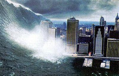
Volcanic Eruption Could Unleash Giant Tsunamis on U.S.
The threat from a collapsing mountain in the Atlantic Ocean could unleash deadly tidal waves on a similar scale to the Asian tsunami, a scientist warned today. Hundreds of millions of people could die in a disaster affecting Britain and the eastern United States.
Professor Bill McGuire called for an early warning system to be installed to counter the potential danger. Researchers have discovered that a chunk of volcano in the Canary Islands the size of the Isle of Man is on the brink of falling into the sea. Scientists believe it could break away when the Cumbre Vieja volcano in La Palma next erupts.
http://www.infowars.com/articles/science/tsunami_volcanic_eruption_us_tsunami.htm
5 years ago
Lastets Info on Volcano Activity:
Veniaminof Volcano (Alaska) 56.17 N, 159.38 W, summit elevation 2507 m, stratovolcano with summit caldera Thursday 6th January 2005 The color code for Mount Veniaminof has been upgraded to “yellow”. This follows ash emissions from the intracaldera cone. Ash emissions are small and rise several hundred feet above the cone. Ashfall is likely to be confined to the caldera. Weak seismic tremor started on January 1, and has increased slightly over the past 2 days. Steam and ash emissions may continue intermittently and could pose a hazard to people and low-flying aircraft in the vicinity of the active cone. This activity is above the normal background level. More on Veniaminof Volcano…Mt Etna Volcano (Italy)
37.73 N, 15.00 E, summit elevation 3350 m, Shield volcano
Sunday 9th January 2005
Ash eruptions were visible at Mt Etna volcano on the morning of 8th January. A significant amount of ash was was emitted from SE crater. A strong northerly wind sent ash towards the south. The activity was of short duration, and the crater returned to steam emissions after one day. This new activity was not preceded by seismic activity, similar to the lava flow last September. A red glow was visible at SE crater, indicating the proximity of magma to the surface. This indicates an increase in activity at the volcano, and the first eruptions from SE crater in more than a year.
More on Mt Etna volcano…
Anatahan Volcano (Mariana Islands)
16.35 N, 145.67 E, summit elevation 788 m, Stratovolcano
Friday 7th January 2005
The third recorded eruption of Anatahan volcano began about 0540 UT (1540 MI) on 4th January. The eruption was preceded by two days of seismic activity at the volcano. The eruption was small and no large explosions were recorded. A low plume of ash up to about 500 ft was visible on January 5th (MI). A hotspot was visible on satellite images indicating the proximity of magma to the surface. The Emergency Management Office, Office of the Governor, CNMI, has placed Anatahan Island off-limits until further notice and concludes that, although the volcano is not currently dangerous to most aircraft within the CNMI airspace, conditions may change rapidly, and aircraft should pass upwind of Anatahan or farther than 30 km downwind from the island and exercise due caution within 30-50 km of Anatahan.
More on Anatahan Volcano…
http://www.volcanolive.com/volcanolive.html
5 years ago
Weather Goes Wild
06-Jan-2005
http://www.unknowncountry.com/news/?id=4355
Brazil has so few tornadoes that it doesn’t even have the equipment to forecast them, but the town of Criciúma (population 180,000) got hit with two of them on Monday. In parts of Alaska, it’s strangely warm—so warm that the annual winter dog weight-pulling contest in South-central Alaska has been canceled because there’s not enough snow. And icebergs have been seen in the waters of New Zealand for the first time since 1948.
Rosamélia de Abreu reports in Brazil Magazine about the one-two punch of tornadoes hitting Brazil. The first one struck around 3 p.m. on Monday and the second one hit about an hour later. Two people were killed and 250 homes were damaged. Meteorologists there say that Brazil does not have the ability to forecast tornadoes more than a couple of hours before they strike, so most people have little or no warning that they’re coming.
Rachel D’oro writes that Alaska is unusually warm this winter. In some places, people have even stopped wearing coats. Roads are a slushy mess, due to freezing and then thawing over and over again. But meteorologists aren’t concerned—they say that weather records dating back to 1917 show that most months of January have a warming period. However, Alaskans who are trudging through slush instead of snow aren’t too happy about it.
Agence France-Presse reports that icebergs have been seen in New Zealand for the first time in 57 years. New Zealanders have been complaining about the weather, and when the icebergs were spotted, they finally understood why. The last year there were icebergs in the local waters was 1948. Nearby Antarctic ice shelves have been collapsing due to global warming. The icebergs won’t be a problem for long, since they’ll eventually drift towards South America, where they’ll finally melt.
5 years ago
MSNBC is now reporting that “something” has altered the earth’s rotation.
MSNBC is now reporting that “something” has altered the earth’s rotation.
http://news.bbc.co.uk/1/hi/in_pictures/4125643.stm
METEOR IMPACTS???
The two 8 + quakes and resulting tsunamis (one south of Tasmania and the second in Indonesia) may have been the result of meteor impacts.
Indonesia has been experiencing waves of meteors – some striking the ground – for about the past two weeks.
The alleged astronomy insider “Aussie Bloke” stated that there would be 3 major impacts. The first would occur in the Pacific Ocean south of Australia (south of Tasmania – the location of the first “quake”)
The other two would be:
1. In the Atlantic off the NW coast of France.
2. In the North Pacific near the Alaska coast.
In one of his quatrains, Nostradamus speaks of a devastating destruction of the French coast around the time of the New Year.
5 years ago
Earth’s Pronounced Wobble Gave Warning Of Quake
http://timesofindia.indiatimes.com/articleshow/984135.cms
Earth’s pronounced wobble gave advance warning of quake!
TIMES NEWS NETWORK[ FRIDAY, JANUARY 07, 2005 09:45:09 PM ]
AHMEDABAD: Mother Earth may have given out warning signals much
before the December 26 earthquake of 9.0 magnitude that struck off
Sumatra in Indonesia, unleashing tsunami waves,which caused
destruction all over the Asian continent.
A leading Indian seismologist, Dr J G Negi said that the observations
made between October 15 and November 30 by the US-based International
Earth Rotation Service (IERS) had revealed early signals of increase
in the earth’s wobble. “During this period, the wobble deviation from
the expected position for this period was approximately 0.75 degrees
which is significant,” he said.
These wobbles are changing rotation of the earth and are known
as ‘Chandler Wobble’ with cycles of 14 months and 6.5 years. Earth’s
wobble is normally supposed to increase during monsoon because of
increased oceanic and atmospheric circulations and decrease around
this time. But the wobble was more pronounced before the December 26
earthquake.
These wobble deviations were followed by earthquake in the southern
hemisphere near Macquarie Trench near New Zealand on December 23 with
a magnitude of 8.1. The earthquakes above 8 magnitude are called great
earthquakes and occur once a year on an average. But on December 26,
only three days later, the northern hemisphere experienced an quake
of 9.0 magnitude in northern Sumatra.
“The wobble of the earth’s rotation clearly anticipated these two big
events,” Negi said. He recalled that there is a revolutionary theory,
which was given in 1967 by L Mansinha and D L E Smiley, two
scientists from Canada,which says that wobbles are co-seismic with
great earthquakes.
In the case of the recent events in December 2004, Negi said, “The big
question is whether earth got jolted after these two earthquakes or
did the prior jolting of the planet, as was shown in the increased
wobble, build up pressure to cause great earthquakes in both the
hemispheres within three days.”
It is already known that the earthquake that unleashed deadly tidal
waves on Asia was so powerful it made the earth wobble on its axis.
US geological survey expert Ken Hudnut said last week “We can detect
very slight motions of the earth and I would expect that the earth
wobbled in its orbit when the earthquake occurred due the massive
amount of energy exerted and the sudden shift in mass.”
Negi says such post-quake wobbling was expected as an earthquake of
such magnitude would “change the natural oscillations of the earth.”
These oscillations, he said, change even during the monsoon when very
large water bodies are formed.
“The earth is not a steady ball and wobbling can happen during change
in the movement of inertia when the mass starts moving differently
with respect to the centre of the earth,” he said.
However, the Indian scientist now feels that the Mansinha-Smiley
theory on the co-relation between wobbling and earthquakes should be
studied in greater detail as it could open up new avenues in
earthquake prediction. Besides, he said, the IERS data is showing an
increase in oscillations in the earth’s rotation and “this shows that
the earth is more disturbed than before.”
5 years ago
Wow Snark, greatest respects… your level of patients with knwo is commendable. I have no formal training in astronomy or geology but I can look up information in my old high school text books and come to more rational conclusions than knwo seems to be able to by using the full resources of the internet.
I hate to say it but I think that an old saying is at play here. If you can’t win them with wisdom bury them in bullshit. I have never seen someone add as many posts to their own thread since I discovered GNN. I guess that it keeps the thread at the top though.
5 years ago
5 years ago
Electromagnetic Radiation Spectrum: (Frequencies List, Definitions, Physics, & Properties, Sources of Radiation,
Overexposure Symptoms, Testing Equipment & Procedures, Exposure
Limits, Standards, & Laws, Shielding & Jamming, Medical & Technical Protection,
EMF Agencies, Organizations To Contact For Help, Reference Materials) :
————————————————————————————————————————
Table of Contents: (Links with a * next to them are empty and in construction)
1.Electromagnetic Radiation Spectrum (0Hz to 10^27 Hz)(Definitions, Physics, & Properties, Sources of Radiation, Overexposure Symptoms, Testing Equipment & Procedures, Exposure Limits, Standards & Laws, Shielding & Jamming, Medical & Technical Protection, EMF Agencies, Organizations To Contact For Help, Reference Materials)
- 2.Earths Ionosphere Cavity Resonance( Schuman Field)(1 Hz to 30 Hz) Radiation
- 5.Television Waves Radiation Spectrum (10^8 to 10^9 Hz, 174 to 216 MHZ, 220MHz, 471-800 MHz, )
- 9.Microwaves Radiation Spectrum( 10^8 Hz to 10^12 Hz)
http://www.rhfweb.com/hweb/shared2/Newrad.html
5 years ago
UNPRECEDENTEDLY WARM WEATHER IN MOSCOW
MOSCOW, January 9 (RIA Novosti) – On Sunday, the Russian capital saw an absolute temperature record. According to Alexei Lyakhov, the head of the hydro-meteorological bureau of Moscow and the Moscow region, the temperature was 4.5 degrees above zero (Celsius) in the morning. The previous record for this day was set in 1976 when the temperature was 2.9 degrees above zero. Lyakhov told the Ekho Moskvy radio station that this was “unprecedented thaw.”
The final record figure over the day will be known in the evening, Lyakhov said. Clearly, warm weather will set in in Moscow in the near future.
“No serious frost should be expected soon,” said Lyakhov.
According to weather experts, the wind is getting stronger in the city.
http://en.rian.ru/rian/index.cfm?prd_id=160&msg_id=5291184&startrow=1&date=2005-01-09&do_alert=0
5 years ago
RUSSIAN AIRCRAFT FAILS TO LEAVE SOUTH POLE DUE TO POOR WEATHER
MOSCOW, January 9 (RIA Novosti) – The Russian An-3T aircraft is stuck in the South Pole due to adverse weather conditions, Matvei Geller, spokesman for the Russian air expedition to the Antarctic, said on the phone from the Antarctic.
According to him, non-flying weather near the McMurdo research station where the expedition is due to arrive has been lasting for six days now. “Visibility is only 2 km, the cloud base is 200-300 metres, it is snowing and there is a strong wind.”
According to weather experts at McMurdo, this situation is untypical for January, which is the peak of the Antarctic summer.
The aircraft was due to leave January 6.
“The expedition participants are used to waiting for better weather. The main thing is that the An-3T aircraft is fully prepared for departure, and the crew has studied the route in detail along with the peculiarities of piloting an aircraft in the Antarctic conditions,” said Artur Chilingrarov, the head of the Russian Antarctic expedition.
Sergei Tarasyuk, the crew head, will decide on flying depending on weather forecasts, Geller said.
The expedition flew to the Antarctic to restore the An-3T aircraft and make an independent
http://en.rian.ru/rian/index.cfm?prd_id=160&msg_id=5290501&startrow=11&date=2005-01-09&do_alert=0
5 years ago
Big Island Summit
Winter Weather Advisory:
Issued at: 1:30 PM HST 1/9/05, expires at: 4:00 AM HST 1/10/05
Winter weather advisory in effect through tonight.
While winds have diminished into the 20 to 25 mph range near the summits, moderate snowfall continues and is expected to continue overnight. Visibilities may be reduced due to blowing snow, requiring caution while driving.
http://www.thehawaiichannel.com/severeweather/3535021/detail.html
5 years ago
1/9/2005 12:52:19 AM Pacific Standard Time
Hello,
This is FYI:
On the evening of December 24th, 2004 at 7 p.m., eastern standard time,
I walked out of my house to bring in my cat for the night. As I was
walking out heading southeast in the yard, I noticed in the direct
southeast what looked like at first sight to be a star falling 90°
down to the earth. It fell in one to three seconds. It was antifreeze
green maybe blue green. I distinctly noticed and mentally noted at that
moment that there was no trail. I have seen large meteors and small
ones; they had trails. I always look up because I am an amateur
astronomer and photographer. This object was about the size of a -1
magnitude star; about the size of Venus on a good night, but it was blue
green. The other thing I noticed that was interesting was that the moon
was nearly full and the sky was cloudless. The night sky was very bright
because the moon was high in the sky. This object that I observed was
about 40° high in the sky when I first noticed it. I am in southern
Ohio and it would put this object over Africa or maybe the Indian Ocean
or somewhere abouts in this region based on what I know about where the
moon is when it rises in the east. It can be directly over Africa and be
hanging in the lower eastern sky in Ohio. The moon was about 60° high
to the east of this object in the east. I also remembered hearing on the
a.m. radio of an asteroid scheduled to hit the earth but later
discovered it was for the year 2029. I also heard something about this
asteroid being so large that if it hit the ocean, it would cause a
tsunami. So, I thought, if I hear of a tsunami on Christmas Day then it
was an asteroid perhaps. I obviously got the 2029 asteroid and tsunami
confused with what I thought was a prediction for an asteroid this week.
Anyway, this is what I saw and my thoughts at the time and it is my duty
to report this sighting.
D.
South Webster, Ohio
pdcrisp@webtv.net
Aprox. latitude: 38.8° N longitude: 82.9°W
Note, 1-9-05: I believe now that the false report (prediction) of an
asteroid hitting Earth was designed to make people think they saw an
asteroid fall when in fact it was a haarp related light. D.C.
http://community-1.webtv.net/crispmusic/TsunamiUFO/
5 years ago
Cyclone threatens Sri Lanka
Colombo – Sri Lanka’s tsunami-battered shores are in danger of being hit by a cyclone which is building off its east coast, the meteorological department warned on Sunday.
“It is not a cyclone at the moment, but there is a possibility of a cyclone within the next 24 hours,” department deputy director Lalith Chandrapala told AFP.
Alerts were being sounded on radio telling people still trying to come to terms with the tsunami devastation to be “cautious and vigilant,” he said.
A low pressure system had developed in the Bay of Bengal around 300km southeast of the town of Hambantota, Chandrapala said.
“There is no immediate threat to Sri Lanka, but if it develops into a cyclone then we will issue a cyclone alert.”
Chandrapala said the department had cautioned all government offices and police on the southeast and eastern coast, especially in districts such as Ampara and towns like Galle, Matara and Hambantota.
“We are telling people to listen to radio bulletins so that they can be alert and if it strikes it is easier to evacuate people,” he said, adding, however, “We are not expecting any need for that.”
A statement by the department said rain or thunderstorms with isolated heavy falls and windy conditions would prevail in the eastern Ulva and southern provinces and in parts of central province overnight and on Monday.
“Strong winds, frequent showers and rough seas are expected in the sea areas off the coast extending from Trincomalee to Matara via Hambantota,” the statement added.
Sri Lanka was seriously damaged by the tsunamis that struck on December 26, with more than 30 700 people killed and almost a million left homeless.
http://www.news24.com/News24/World/Tsunami_Disaster/0,,2-10-1777_1644851,00.html
5 years ago

A strong earthquake was recorded off Indonesia close to the site of a massive quake two weeks ago that unleashed tsunamis that killed thousands of people across Asia, the Hong Kong Observatory (n
http://story.news.yahoo.com/news?tmpl=story&u=/050110/photos_sc_afp/050110002549_g9rgf2zp_photo0
5 years ago
Quakes rock Taal Volcano
Moderate volcanic earthquakes rocked Taal Volcano on Sunday, causing some residents to flee the area for fear of a possible tsunami, ABS-CBN News learned Monday.
Phivolcs official Allan Luz advised the public to remain calm, adding that volcanic quakes do not usually result in tsunamis.
http://www.abs-cbnnews.com/FlashNewsStory.aspx?FlashOID=22824
5 years ago
even though neverknwo comes across as weird i think all these extreme weather conditions should serve as a wake up call. think about it, we are heading towards our own destruction really fast. i agree with neverknwo with the point that something really weird is going on. in the months leading up to the tsunami in south east asia there were quite a few incidents of whales washing up on beaches in australia. this was very mysterious at the time and happened on a number of occasions.
5 years ago
5 years ago
http://www.stewartswerdlow.com/CurrentNews.cfm
World Weather Woes January 09, 2005
When the massive quake in Asia struck, the Earth’s axis wobbled and weather patterns were abruptly affected. Since then, there have been tornadoes in Brazil, Scandinavia, and the US. There have also been amazing amounts of rain and snow in California and Nevada, as well as bitterly cold air over Canada and the Central US. The heavy rain in California will seep into the dry fault line areas causing slippage and movement. Western Australia weather has also been fluctuating wildly. The UK has been inundated with wind and rain. It only takes a slight movement of the Earth’s magnetic fields to change weather and seismicity. We should all prepare for a wild ride the next few months.
5 years ago
LARGE ASTEROID STRIKES EARTH!
DAMAGE NOT AS BAD AS EXPECTED.

By COLLEEN MENSCHING
Staff Writer
REDLANDS – Firefighters and police spent the weekend responding to weather-related calls, including more than 10 car accidents, a couple of felled trees, closed roads and a group of cars stuck in mud at the intersection of San Timoteo Canyon and Live Oak Canyon roads, according to officials.
http://story.news.yahoo.com/news?tmpl=index2&cid=702
5 years ago
5 years ago
How the Earthquake
affected Earth
NASA Science News for January 10, 2005
The Dec. 26th Indonesian megathrust earthquake quickened Earth’s
rotation and changed our planet’s shape, according to calculations done
by NASA scientists.
FULL STORY at
http://science.nasa.gov/headlines/y2005/10jan_earthquake.htm?list1129408
Home page: http://science.nasa.gov
5 years ago
NASA Claims Polar Shift Due In 2012
Solar System – Did you notice? In February 2001, the Sun did a magnetic polar shift. The next one is due again in 2012. NASA scientists who monitor the Sun say that our star’s awesome magnetic field flipped 22 months ago, signaling the arrival of a solar maximum. But it wasn’t so obvious to the average human.
The Sun’s magnetic north pole, which was in the northern hemisphere just a few months ago, now points south. It’s a topsy-turvy situation, but not an unexpected one. “This always happens around the time of solar maximum,” says David Hathaway, a solar physicist at the Marshall Space Flight Center. “The magnetic poles exchange places at the peak of the sunspot cycle. In fact, it’s a good indication that Solar Max is really here.”
The Sun’s magnetic poles will remain as they are now, with the north magnetic pole pointing through the Sun’s southern hemisphere, until the year 2012 when they will reverse again. This transition happens, as far as we know, at the peak of every 11-year sunspot cycle — like clockwork.
Earth’s magnetic field also flips, but with less regularity. Consecutive reversals are spaced 5 thousand years to 50 million years apart. The last reversal happened 740,000 years ago. Some researchers think our planet is overdue for another one, but nobody knows exactly when the next reversal might occur.
Although solar and terrestrial magnetic fields behave differently, they do have something in common: their shape. During solar minimum the Sun’s field, like Earth’s, resembles that of an iron bar magnet, with great closed loops near the equator and open field lines near the poles. Scientists call such a field a “dipole.” The Sun’s dipolar field is about as strong as a refrigerator magnet, or 50 gauss (a unit of magnetic intensity). Earth’s magnetic field is 100 times weaker.
When solar maximum arrives and sunspots pepper the face of the Sun, our star’s magnetic field begins to change. Sunspots are places where intense magnetic loops — hundreds of times stronger than the ambient dipole field — poke through the photosphere.
“Meridional flows on the Sun’s surface carry magnetic fields from mid-latitude sunspots to the Sun’s poles,” explains Hathaway. “The poles end up flipping because these flows transport south-pointing magnetic flux to the north magnetic pole, and north-pointing flux to the south magnetic pole.” The dipole field steadily weakens as oppositely-directed flux accumulates at the Sun’s poles until, at the height of solar maximum, the magnetic poles change polarity and begin to grow in a new direction.
Hathaway noticed the latest polar reversal in a “magnetic butterfly diagram.” Using data collected by astronomers at the U.S. National Solar Observatory on Kitt Peak, he plotted the Sun’s average magnetic field, day by day, as a function of solar latitude and time from 1975 through the present. The result is a sort of strip chart recording that reveals evolving magnetic patterns on the Sun’s surface. “We call it a butterfly diagram,” he says, “because sunspots make a pattern in this plot that looks like the wings of a butterfly.” In the butterfly diagram, pictured below, the Sun’s polar fields appear as strips of uniform color near 90 degrees latitude. When the colors change (in this case from blue to yellow or vice versa) it means the polar fields have switched signs.
The ongoing changes are not confined to the space immediately around our star, Hathaway added. The Sun’s magnetic field envelops the entire solar system in a bubble that scientists call the “heliosphere.” The heliosphere extends 50 to 100 astronomical units (AU) beyond the orbit of Pluto. Inside it is the solar system — outside is interstellar space.
“Changes in the Sun’s magnetic field are carried outward through the heliosphere by the solar wind,” explains Steve Suess, another solar physicist at the Marshall Space Flight Center. “It takes about a year for disturbances to propagate all the way from the Sun to the outer bounds of the heliosphere.” Because the Sun rotates (once every 27 days) solar magnetic fields corkscrew outwards in the shape of an Archimedian spiral. Far above the poles the magnetic fields twist around like a child’s Slinky toy.
Because of all the twists and turns, “the impact of the field reversal on the heliosphere is complicated,” says Hathaway. Sunspots are sources of intense magnetic knots that spiral outwards even as the dipole field vanishes. The heliosphere doesn’t simply wink out of existence when the poles flip — there are plenty of complex magnetic structures to fill the void.
Or so the theory goes…. Researchers have never seen the magnetic flip happen from the best possible point of view — that is, from the top down. But now, the unique Ulysses spacecraft may give scientists a reality check. Ulysses, an international joint venture of the European Space Agency and NASA, was launched in 1990 to observe the solar system from very high solar latitudes. Every six years the spacecraft flies 2.2 AU over the Sun’s poles. No other probe travels so far above the orbital plane of the planets. “Ulysses just passed under the Sun’s south pole,” says Suess, a mission co-Investigator. “Now it will loop back and fly over the north pole in the fall.”
“This is the most important part of our mission,” he says. Ulysses last flew over the Sun’s poles in 1994 and 1996, during solar minimum, and the craft made several important discoveries about cosmic rays, the solar wind, and more. “Now we get to see the Sun’s poles during the other extreme: Solar Max. Our data will cover a complete solar cycle.”
To learn more about the Sun’s changing magnetic field and how it is generated, please visit “The Solar Dynamo,” a web page prepared by the NASA/Marshall solar research group. Updates from the Ulysses spacecraft may be found on the Internet from JPL at http://ulysses.jpl.nasa.gov.
(Source: http://science.nasa.gov/headlines/y2001/ast15feb_1.htm)
(In accordance with Title 17 U.S.C. Section 107, this material is distributed without profit to those who have expressed a prior interest in receiving the included information for research and educational purposes.)
http://www.gvnr.com/74/3.htm


No comments:
Post a Comment